
Day Hikes in El Chaltén, Patagonia

Fitz Roy, El Chaltén, Patagonia
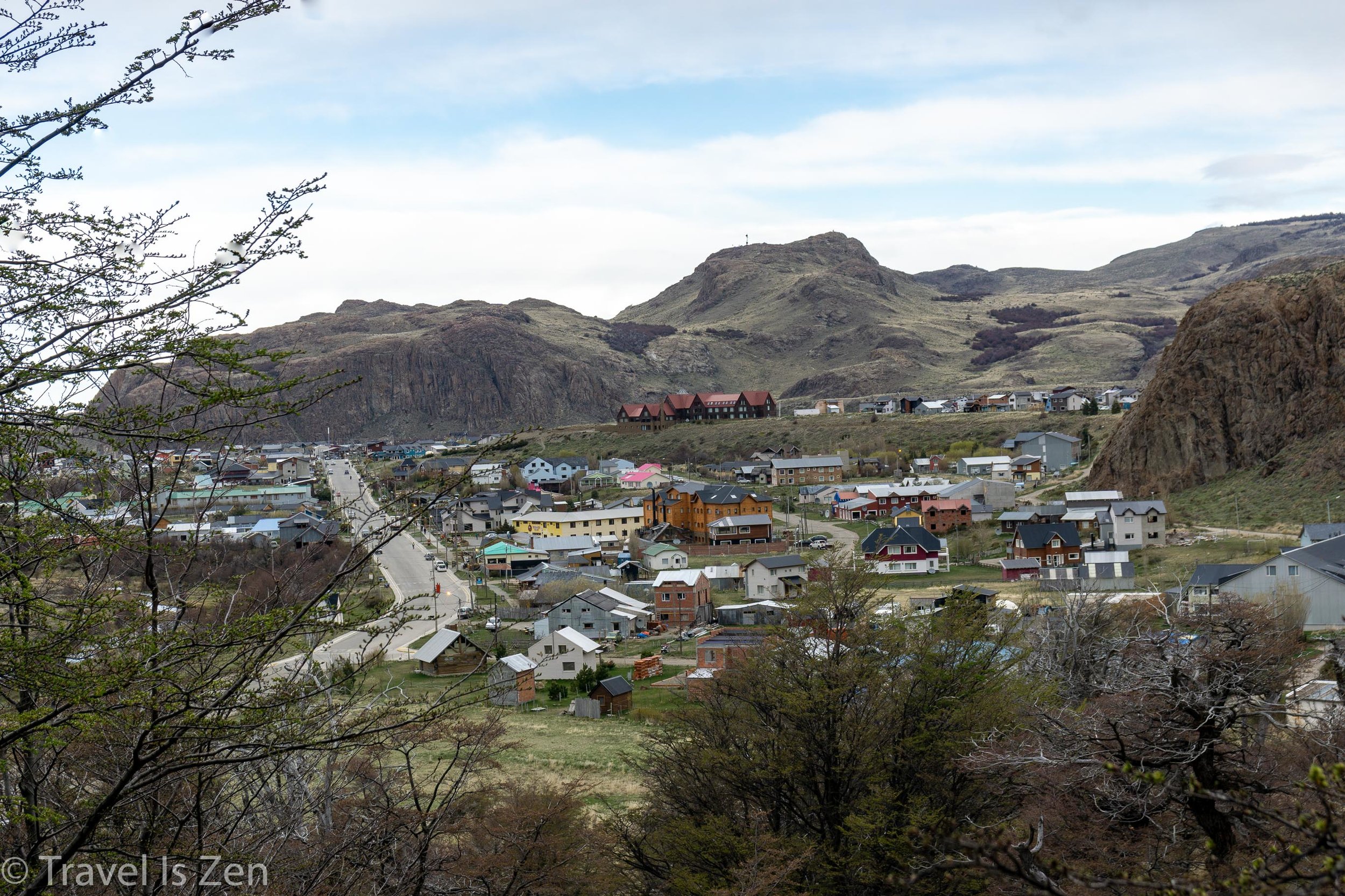
El Chaltén is a trekker’s paradise. This small frontier town sits on the edge of Los Glaciares National Park, in a valley at the confluence of two rivers. Stark granite massifs protrude from grassy perimeter hills like guardian giants warding the backcountry.
El Chaltén, Los Glaciares National Park, Patagonia
The town itself is a hodge-podge of tightly-spaced do-it-yourself brick and corrugated tin houses, yurts, permanently parked trailers, and brightly painted tiny homes. With only the main road paved, there are more horses and off-road motor bikes than cars. But tourism is booming and the city is expanding, with plenty of restaurants, grocery stores, and souvenir shops. We spent six nights in El Chaltén, which was just about perfect.

From El Chaltén town center, there are plenty of trail options for all types of hikers, from easy strolls to hilly day hikes to extended multi-day circuits through the glacier ice fields. Just strap on your boots, grab your day pack and go. Here are three trails that we loved (we enjoyed two of them so much that we did them twice!).
Hike #1: Sendero Laguna de Los Tres and Fitz Roy (15 Miles Round Trip)
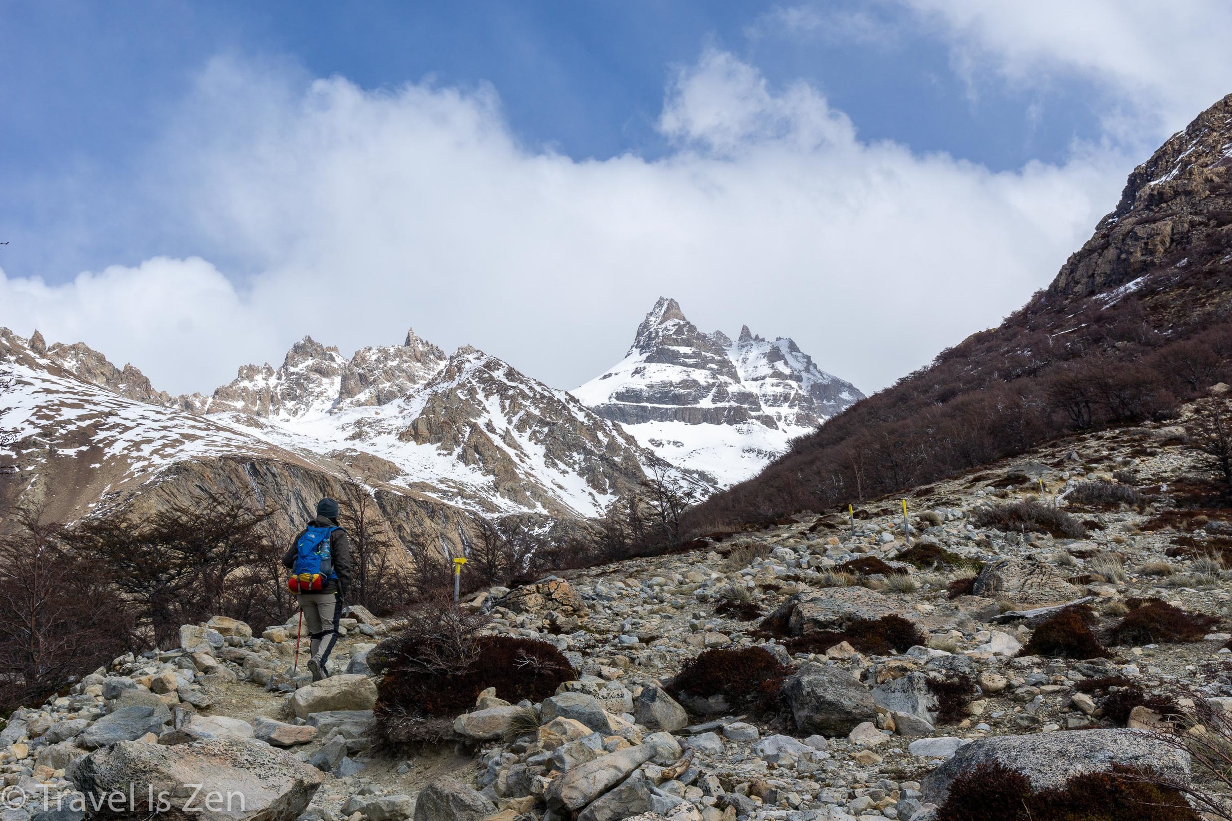
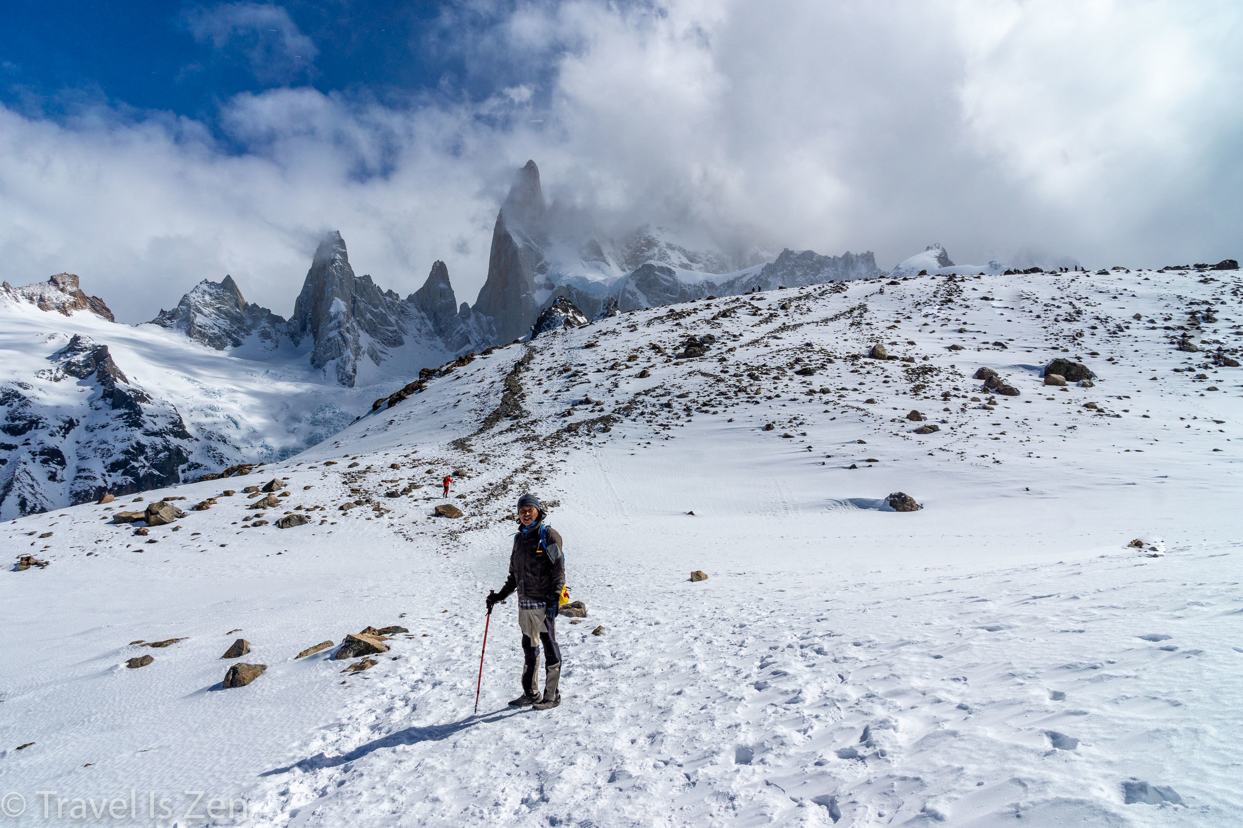
Icy trail past Camp Poincenot
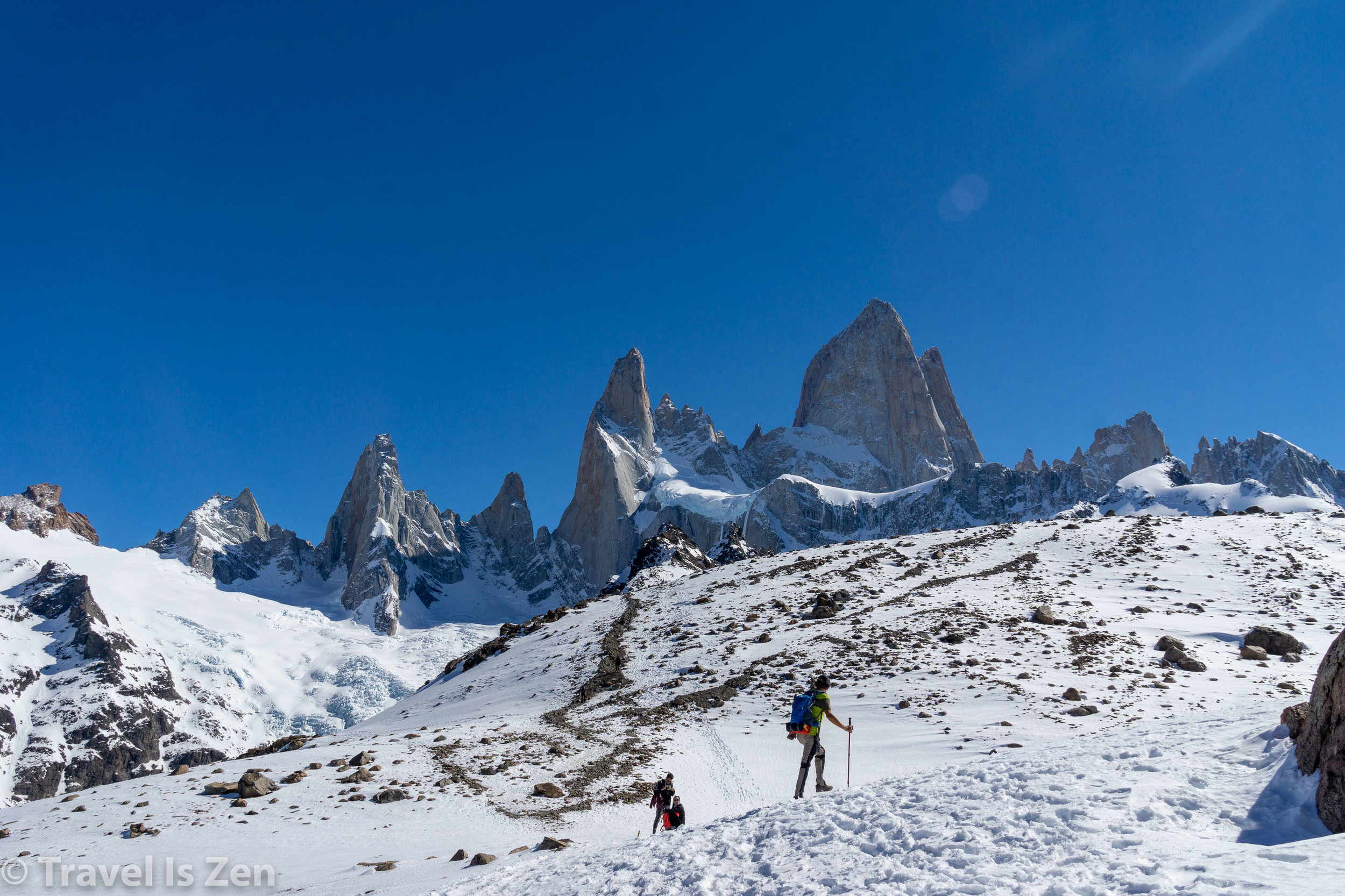
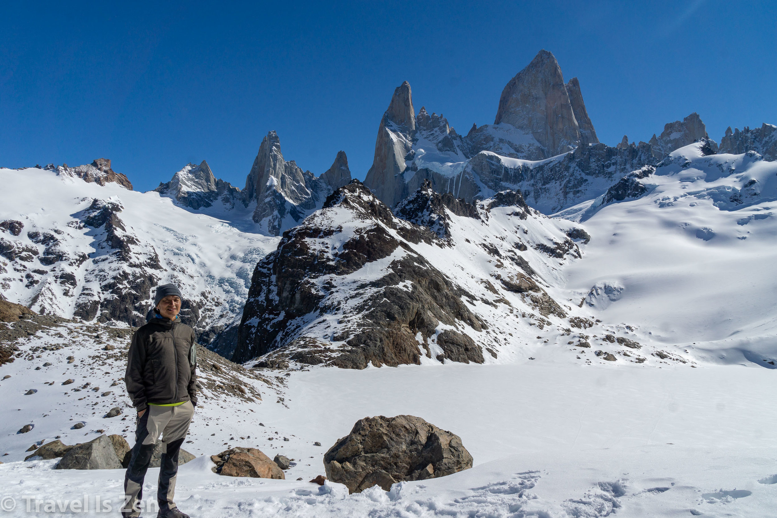
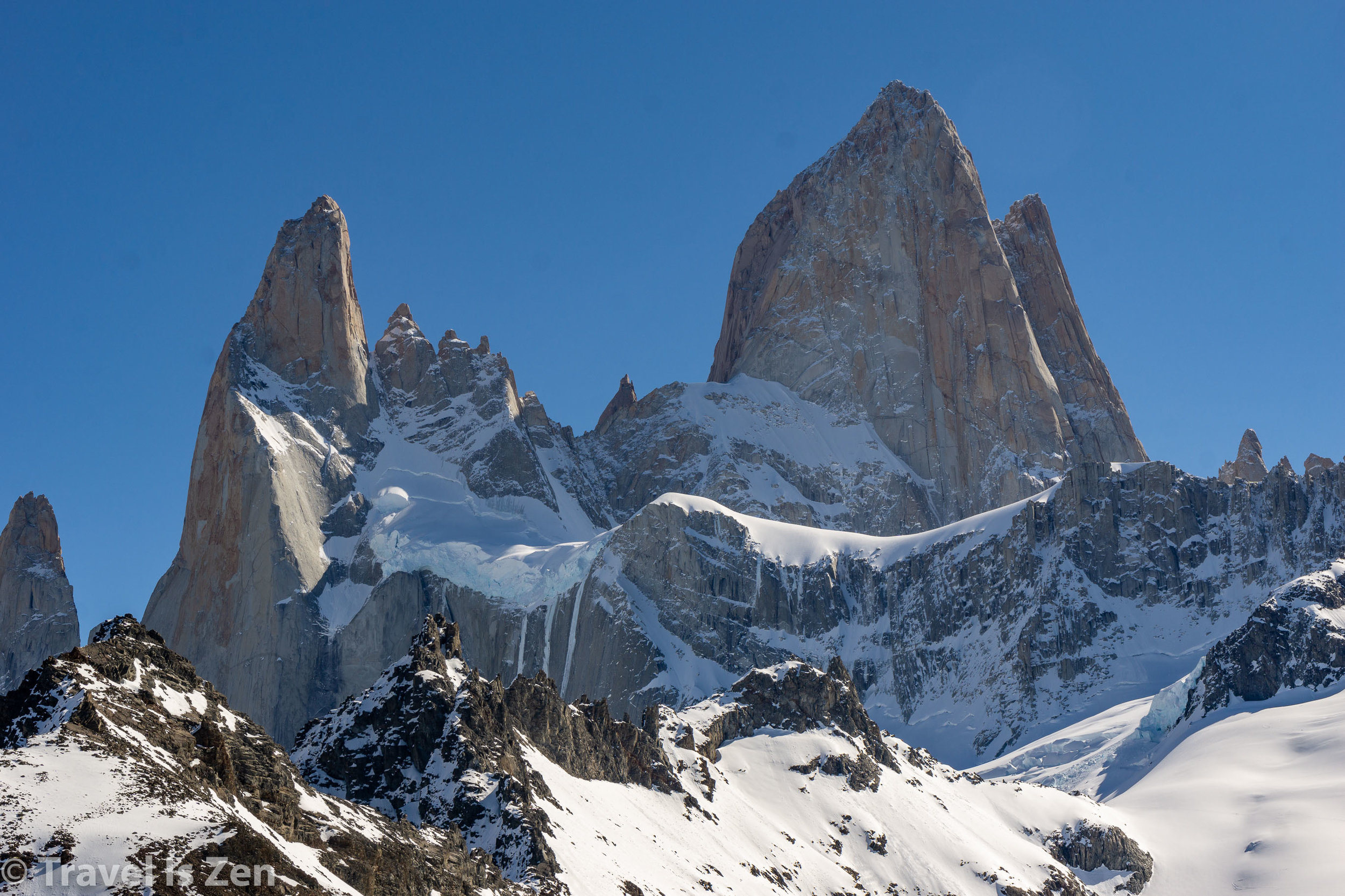
Cerro Fitz Roy is king of Los Glaciares National Park. Its cold granite peak punctures the clouds at over 11,000 feet and it’s one of the most technically challenging rock climbs on the planet. Don’t worry, this is not a summit hike! This trail takes you to an overlook of the lake in front of the imposing rock tower, Laguna de Los Tres. It is a fairly challenging hike, though. We recommend taking your walking sticks and, if you go in the early Spring (September, October), you may need crampons if the overlook trail past Camp Poincenot is still covered in ice.
The trail starts at the upper end of town, with a steep rise through the grassy foothills overlooking Rio de los Vueltas. Then it plunges into a dark forest of weathered, lichen-bearded trees, crippled by wind and snow. Watch for the oversized red-headed woodpeckers, austral parakeets and caracaras.


Soon, the trail divides. One route goes to Lake Capri; the other to Fitz Roy Mirador (viewing site). Both provide terrific views of Fitz Roy and eventually merge back together to continue to Lagunas de los Tres. There is a campground with toilet facilities at Lake Capri. Many people choose to camp at Lake Capri for night photography, capturing Fitz Roy surrounded by the brilliant stars of Patagonia and moon-lit reflections on the still lake.
View from Fitz Roy mirador along the Sendero Laguna de los Tres
The divergent trails merge shortly and continue as a single path. El Chaltén is in a region where the arid steppe transitions into mountains, a terrain called ecotone. The trail hugs the base of low-rising hills, winding through flat, sandy grasslands, flooded bogs, and past wind-swept dunes and depressions. The pale skeletons of exposed tree carcasses litter the valley. In the distance, the icy blue face of Piedras Blancas glacier injects an unexpected pop of color. Over this landscape, Mount Fitz Roy presides from his throne, flanked by smaller towers Poincenot and Mermez, ever-present and visible.

Heading to Fitz Roy


A fork in the road directs hikers to Piedras Blancas glacier viewing point, about 1/2 mile on the right hand trail. It’s worth the extra steps to see the frigid wall of water poised in time. From the clearly-marked mirador spot, backtrack to the fork to continue towards Laguna de los Tres.
View from Piedras Blancas mirador on Sendero Laguna de los Tres
Shortly, the trail cuts through Camp Poincenot, another popular tent site for sunrise photo seekers expecting to hike the Laguna de los Tres overlook hill in time to catch the morning sun rays beaming on the three amigos, Fitz Roy, Poincenot, and Mermez. Camp Poincenot marks the six mile point along the hike. Traversing a couple of bridges over bleached boulders and a clear, cool river, the trail ducks back into the forest, where it begins to climb out of the wooded green and up a barren, rocky trail. This is the toughest part of this trail, but worth the sweat, so hang in there! After 3/4 of a mile, the trail finally levels out for a brief stretch before making a final, steep ascent up a scree-covered rise to the mirador. When we visited, Laguna de los Tres was frozen and snow covered. Hope you get to see the coveted lake reflection!


This is an out-and-back trail, so after ogling the view and eating a picnic lunch, simply return on the same path (maybe choosing the Fitz Roy mirador fork, if you took the Lake Capri fork on the way in…or vice versa).
Hike #2: Sendero Laguna Torre (13 Miles Round Trip)

Cerro Torre, El Chaltén, Patagonia, Argentina
Cerro Torre is another impressive spire in El Chaltén, luring rock climbers from around the world to test their skills and mettle. At the top of this massif is a permanent glacier, so a summit is possible only for those with true grit! Once again, we are sticking to the low road to admire this beauty. The trail starts at the upper end of El Chaltén, on a grassy knoll with a bird’s eye view of the town. Proceed across the meadowlands, passing Margarita waterfall and a glimpse of Fitz Roy about a mile into the hike. The trail continues to undulate over the steppe lands surrounding the city. A few miles in is another mirador point, with views of Mounts Solo, Grande, and Adelas and the pointy needles of Cerro Torre (3133 meters), Eggar (2685 meters), and Standhart (3050 meters). The mass of ice at the base is Torre Glacier. Off to the far right are the tops of Poincenot and Fitz Roy.

Cerro Torre mirador along the Sendero Cerro Torre
From here, the trail plunges into the river valley, where it flattens out along Rio Fitz Roy. This section is quite rocky, but otherwise easy. Cerro Torre is constantly in view until the trail winds back into the wooded area along the base of the hill on the right.
Click any photo for a larger slideshow…


Less than half a mile from Lake Torre is DeAgostini base camp. It’s a nice picnic area if the winds are too strong at the lake and it has a porta-potty. Crunching over layers of gravel up and over an enormous ridge of glacial deposits, Lake Torre is finally revealed, with bobbing azul glacial ice in frigid green waters.


Follow the same trail back into El Chaltén. This trail is not hard, but it is deceivingly long. The return trip has a few steep climbs towards the end, so make sure you save some energy. If you aren’t sure you can make the entire hike in one day, then pitch a tent and enjoy the sunrise at Camp DeAgostini.
Hike #3: Sendero Loma del Pliegue Tumbado (13 Miles Round Trip) MY FAVORITE HIKE
View from Loma del Pliegue Tumbado, including Laguna Torre and Fitz Roy
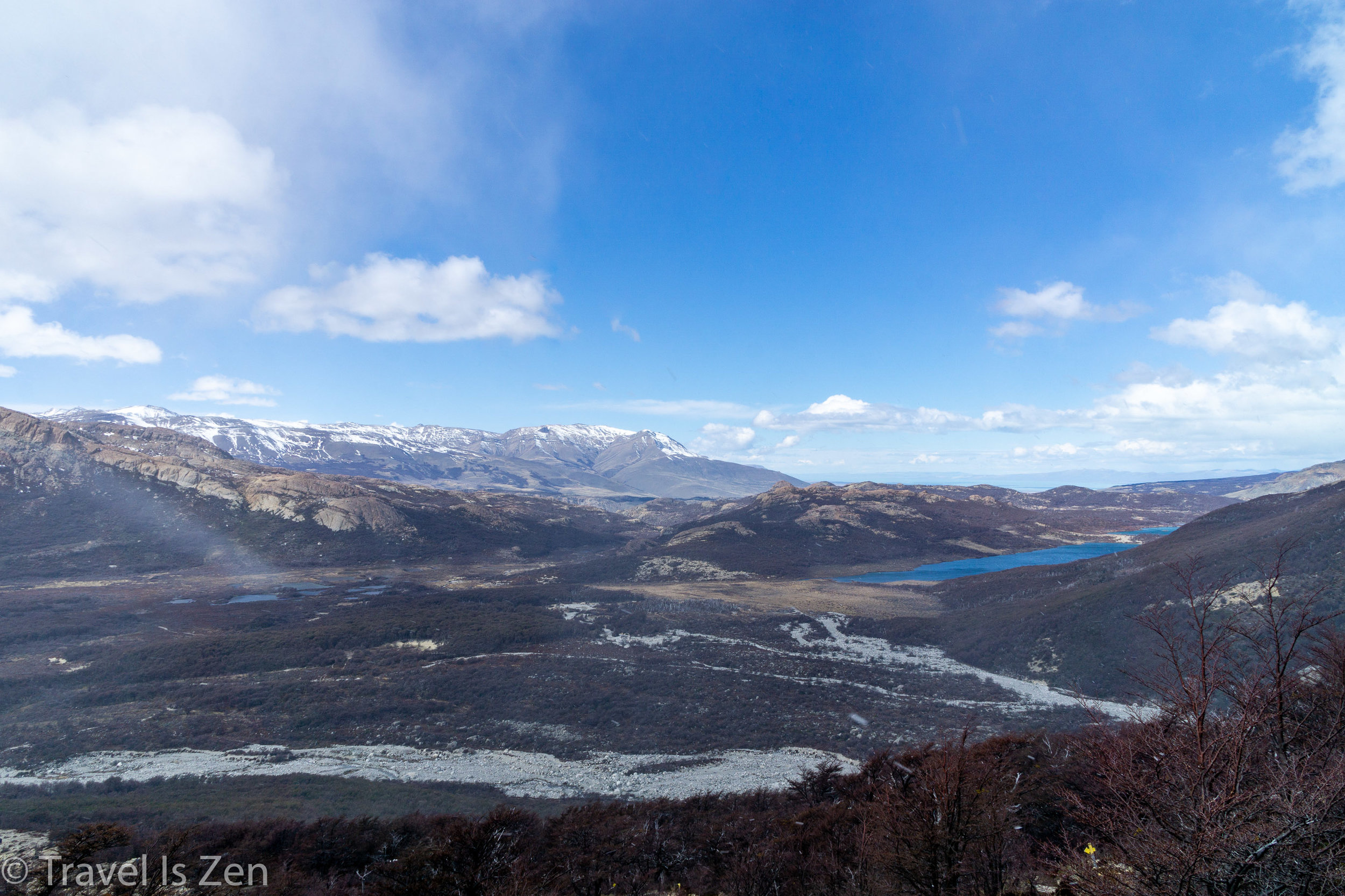
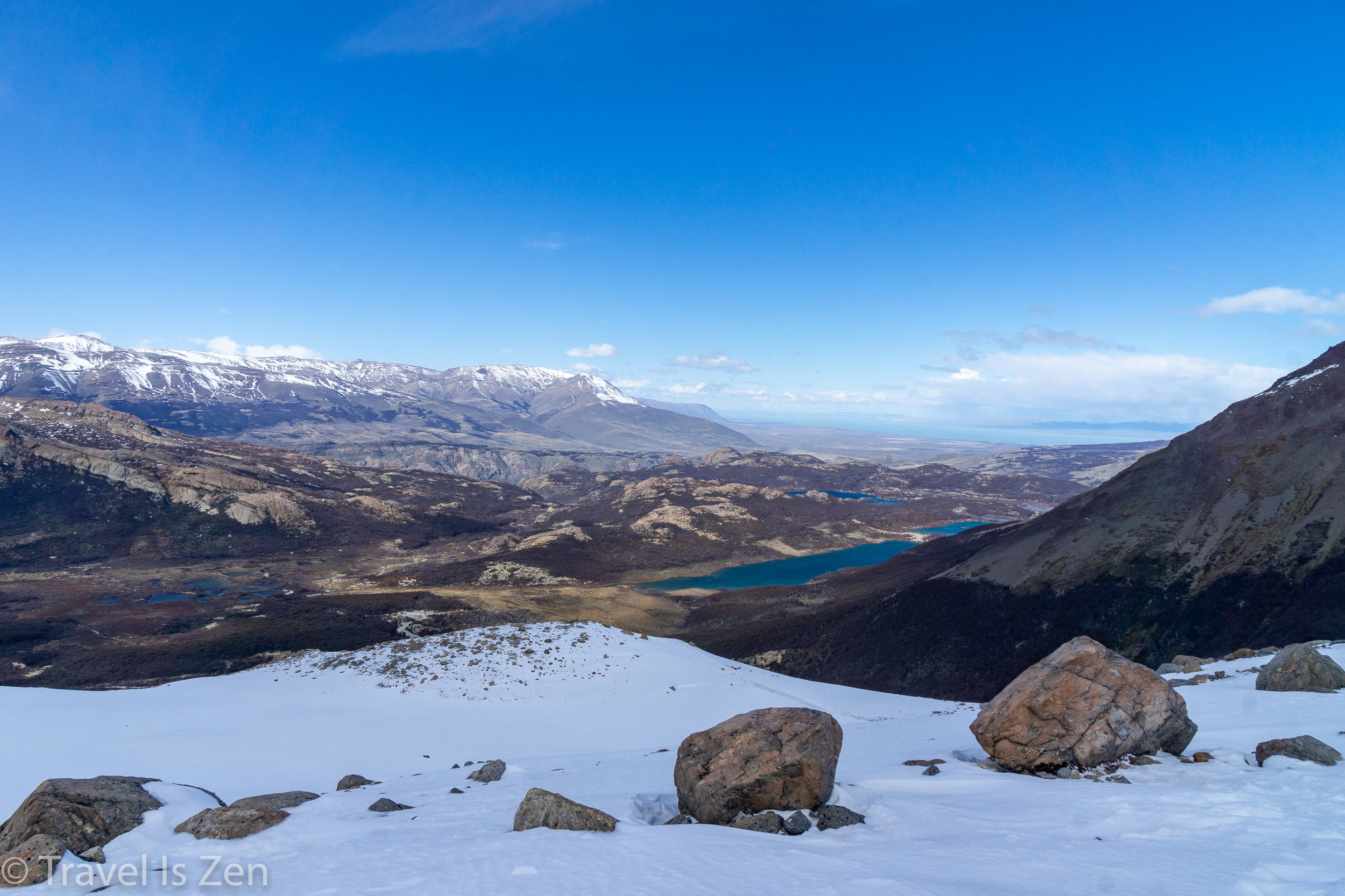
The trails mentioned above steal all the limelight, but the Loma del Pliegue Tumbado trail wins for best all-around views. In my opinion, if you only do ONE hike, THIS IS IT because you get panoramic views of El Chaltén, Lake Viedma and the pampa steppeland, the expansive Patagonian ice field, Mount Fitz Roy and Cerro Torre all in a single day hike. The terrain also varies throughout the hike, from grassy hills to dark wooded forest, through cow pastures and across rocky slopes void of vegetation. At the apex, you feel like you’re on top of the world!
The trail starts near the Visitor Center across the Rio Fitz Roy. It’s a constant slow-but-steady ascent for several miles through meadows and pasture. Patagonian condors soar overhead.


The trail levels off in a muddy bog area, with rust-colored scrub grass and Fitz Roy in the distance. Across the bog, the path leads into a dark forest of stout, weathered beech trees and begins ascending again. Exiting the forest, the trail continues across a vast plateau of gravel and rocks interspersed with tough mossy turf and trickling rivulets of melt water. We hiked in the Spring, before the snow had melted. At times, we were knee deep in the snow tracks of prior hikers. Might have been a good idea to have snow shoes! From here, you can see Lake Viedma.


Views of Fitz Roy from Sendero Loma del Pliegue Tumbado, Patagonia, Argentina
Lake Viedma from Sendero Loma del Pliegue Tumbado, Patagonia, Argentina
Across the windy plateau and up another steep slope, the trail terminates at the Laguna Torre mirador. From here, you get a grand view of the (receding) Grande Glacier and the Laguna Torre trail from above. Continue up the last high hill in sight for the 360 degree panoramas of Glacier National Park and Lake Viedma. With no pollution, visibility is incredible!


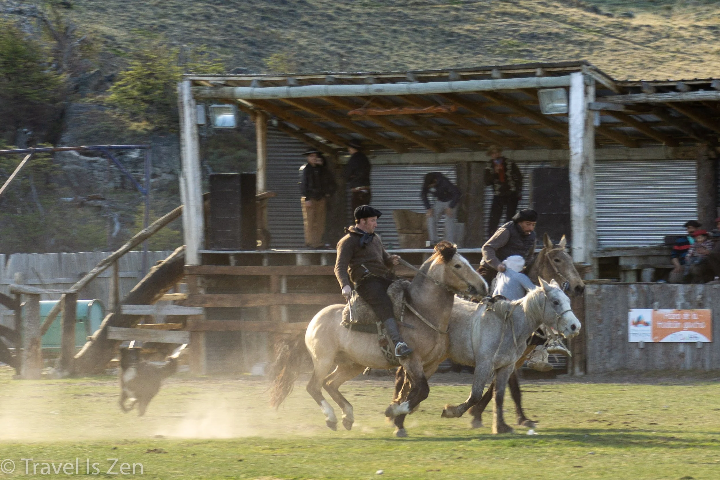
Rodeo Practice in El Chaltén
After one of our day hikes, we ambled back into town, walking along a dusty road towards the place we were staying. A commotion in a field caught our attention; upon closer inspection, we were thrilled to watch some real cowboys breaking in some horses! Seems that real cowboys wear berets and their horse skills were impressive!
Click any photo for a larger slideshow…


How to Get to El Chaltén, Patagonia
There are direct flights from Buenos Aires to El Calafate, with daily bus service from El Calafate airport to El Chaltén. Flight time is 3 1/4 hours and the price was about USD$200 in October 2018. Prices fluctuate like a bouncing rubber ball in Argentina, though, so check the Argentina peso to US dollar rate. When we visited, it was 37:1 (37 pesos to 1 dollar), which was highly in our favor.
We were in Bariloche in northern Patagonia before we traveled further south to El Chaltén. We opted to take an overnight 24 hour bus ride from San Carlos de Bariloche to El Chaltén, which cost about USD$80 per person (Oct. 2018). We returned to Buenos Aires by air from El Calafate. The flight was 3 hours and cost about USD$230 (Oct. 2018).


