Hike in Gyeryong National Park, South Korea
Just two hours south of Seoul by bus, the eight scenic views of Gyeryongsan National Park (계룡산국립공원사무소) await your discovery. This small but important forest area was designated as the country’s second national park in 1968, after Jirisan. It’s claim to fame is the spiritual sense of well-being and clarity people attain when hiking and meditating in the park (similar to the “energy vortex” visitors ascribe to Sedona, Arizona).
Gyeryong Mountain has been held sacred since ancient Baekjae Kingdom times. It’s peak is less than 3,000 feet high, but it sits at the edge of a vast plain on the western coast of Korea. From the lowlands, the ridge looks like a mighty dragon (“yong” 용) with a rooster’s comb (“gye” 계) — this gives you a clue to its name.


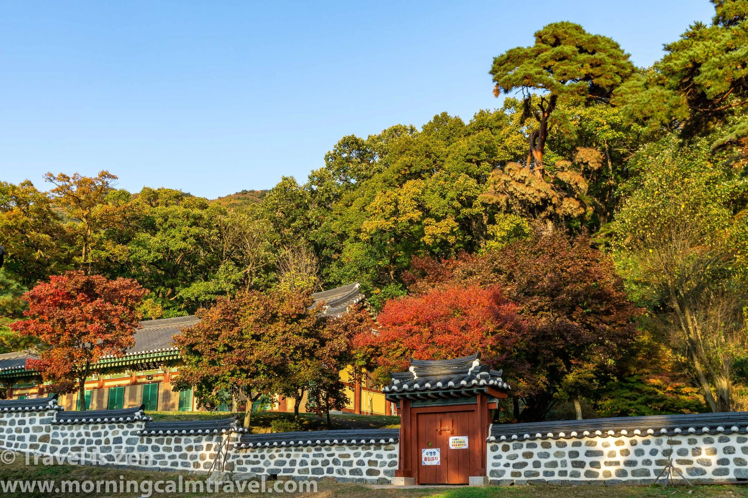
The park has several courses, all less than 10 kilometers in length, with varying degrees of difficulty. There are eight key scenic points throughout the park, described in the park’s English language brochure, which is freely available along with maps at the tourist information center. There are also three Buddhist temples with over 1,000 years of history: Donghaksa, Gapsa, and Sinwonsa Temples. By stringing together a couple of courses, you can see most of the sites in one day. Our route included six of the eight sites, two peaks, and two temples.


We started near the Gyeryongsan National Park Office and proceeded along Donghak valley (designated as the 5th scenic viewpoint), through a nature preserve to Donghaksa Temple. Donghaksa Temple was built in the Shilla Kingdom era and is surrounded by old cherry trees. During the spring bloom, visitors flock here in droves. It’s name means East (Dong 동) Crane (Hak 학) Temple (Sa 사), deriving its name from a crane shaped rock to the east of the temple.


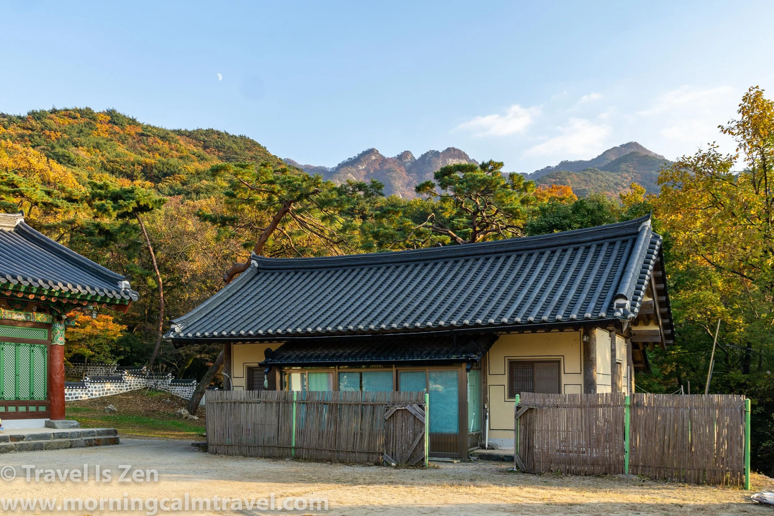
Just past the Eunson Waterfall (7th scenic wonder), the trail ascends along an uneven, rocky path before eventually becoming a steep staircase up the side of a bare cliff to the first of several overlooks. To the top of Gwaneumbong peak 관음봉, the trail alternates between rock path and stairs (Korean version of a via ferrata).


From Gwaneumbong, it’s an up-and-down ridge walk to Sambulbong peak (삼불봉), another designated scenic point. We took a short round-trip side path to Nammaetap (남매탑) to see the Brother and Sister pagodas (the eighth scenic view).
Nammaetap has a cute story: A tiger approached a monk and roared. The monk noticed a thorn painfully piercing the tiger’s throat, so he plunged his hand into the tiger’s mouth and plucked out the thorn. To show his gratitude, the tiger brought the monk a young woman the next day. Since the monk had taken celibacy vows, he and the woman established a sworn brother and sister relationship. Together, they lived a life of service and religious discipline at a hermitage in the hills of Gyeryongsan. The seven and five story pagodas (Nammaetap) were built during the Goryeo Dynasty era over 1,000 years ago to commemorate the saints’ religious devotion.
Heading back up the stone staircase, we then followed signs to Gapsa Temple, descending once again to a valley floor. Gapsa Temple dates back to 420 A.D., making it one of the oldest temples in Korea. The autumn foliage in November is gorgeous in Gapsa valley, making it the 6th of eight scenic views within the park.