
John Muir Trail: Days 10-15 VVR to Golden Staircase
The unprecedented 2022 monsoon rains in southern California shaped the next six days on the John Muir Trail. This is where our “walk in the woods” became a real adventure, testing our perseverance, risk tolerance, and adaptability. We all learned a little something about ourselves and each other… and I earned a trail name.


This post covers the third leg of our JMT hike, from Vermillion Valley Resort to our turn-around on the Golden Staircase (roughly miles 92-144 of the JMT heading SOBO). Highlights in this section include: Bear Creek, Selden Pass, Sallie Keyes, Muir Trail Ranch (MTR), Kings Canyon, Evolution Creek, Evolution Lake, Muir Pass, Le Conte Canyon, and Golden Staircase.
Camp #9: Bear Creek (8.5 miles) @ 8,800 feet
Leaving Vermilion Valley Resort (VVR), we were red-faced and sweaty as we hiked along the 4 mile Bear Ridge trail. The air was humid and rain was eminent.


Earlier than planned, we set up camp near Bear Creek, thunder rumbling. We climbed inside the tent as a mist turned into a downpour. It moved along by 3:00, leaving behind chilly air and fog. We dangled our feet in the creek, I listened to a podcast, scrutinized the canyon walls, passed the time... After all the chatter and music at VVR, the singular sound of the rushing creek water was soothing. The rain started up again at dinner time and we ate a somber meal inside our tents. Today’s elevation change included 2,600 feet of climbing and 1,021 feet of descent with average slope of 426 feet/mile.
Camp #10: Muir Trail Ranch (12.5 miles) @ 7,500 feet
The mosquitoes were waiting to pounce the next morning. After wolfing down my super-charged oatmeal (Kodiak oatmeal + chia seeds, dried blueberries, slivered almonds) and hastily packing up, I charged ahead of Caffrey and Dan, hell bent on getting to a higher elevation as quickly as possible.
Note: For image slide-show, click on any photo.


We were above 10,000 feet — the “no mosquito zone” — by 9:30 in the morning and had a snack at Marie Lakes, just below Selden Pass (10,800 feet), before noon. Thick heavy clouds closed in around us as we climbed to Selden Pass, obscuring the peaks. For the next several hours, we walked in a hard rain and white fog past Heart Lake and Sallie Keyes. We scarfed down lunch at Sallie Keyes during a momentary break in the downpour, then continued onward - ponchos flapping, heads down, shoes squishing in mud.
Note: For image slide-show, click on any photo.


We were about halfway down the switchbacks to Muir Trail Ranch when the sun managed to briefly pop through the cloud cover, putting a smile on our faces as we marched forward to our re-supply.


We arrived in a downpour at Muir Trail Ranch with an hour to spare before they closed the re-supply shack. On long make-shift wooden tables beneath canopies, we worked fast to toss, horse-trade, pack and re-pack our bear buckets with the contents of our second re-supply. It was cold and the general mood among the hiker crowd was dismal after two days of hard rain. Word had spread that thunderstorms were going to continue the rest of the week, with the potential for hail, lightening, flash flooding and landslides. A rumor floated that Mt. Whitney Portal was closed due to flooding. Several people scrutinized a wall map, discussing various escape routes out of the wilderness. The shortest path to town via Piute Pass was a 2 or 3 day journey from Muir Trail Ranch (MTR). The reality of being deep into the Sierra Nevada mountains really hit me. Our current location was literally days from civilization. We couldn’t just throw in the towel on a whim and check into a comfy hotel. We had to think and plan DAYS in advance in terms of safety and comfort.
After another dinner hunkered down from the rain in our tents, I poured over maps, plotting out every escape route between MTR and Onion Valley, calculating mileage and days-to-exit. We were not quite ready to bail off the JMT yet, so we agreed to press onward. We would have another opportunity to exit at Bishop Pass, about 30 miles ahead. It had been a long day and my head hit the pillow at 7:30 for a restless night’s sleep. Today’s elevation gain/loss over 12.5 miles of puddles included 1,932 feet UP and 3,486 feet DOWN on slopes averaging 435 feet/mile.
Camp #11: Evolution Creek (8.8 miles) @ 9,200 feet
I woke up in a foul mood inside a damp smelly tent and wiggled into wet socks and dirty clothes. Caffrey’s incessant brightness was on my last nerve; I glared, pouted and stomped around getting ready for another day of sloppy slogging. Fortunately for everyone, the sun’s morning rays pierced the fog and even I couldn’t stay gloomy. With high hopes that forecasted weather fears were exaggerated, we left MTR with heavier packs but lighter spirits. With the sun shining brightly in blue skies, everything seemed more beautiful. The hike out of Muir Trail Ranch along the creek and through the forest was relatively flat, easy and scenic.
Note: For image slide-show, click on any photo.


At the footbridge leading into Kings Canyon National Park, we unpacked all of our things and air-dried them in the sun. We were happy to see our friend Karina one last time before her exit over Piute Pass. We chatted, laughed, and tried to ignore the cloud build-up in the distance.


Kings Canyon was gorgeous. We ate tuna wraps and crispy Frito chips along the creek near John Muir Rock, lingering until we felt the first splatters from the dark sky overhead. We scurried into the tall pines and tried to wait it out, but it soon became clear that the rain had no intention of speeding along. We resigned ourselves to another drenching afternoon and headed for Evolution Meadows. Unlike the prior day, the clouds hovered above the peaks, allowing us to appreciate the rugged terrain and turbulent waterfalls through a shroud of misty drizzle.


We caught another lucky break in the weather just as we reached the ford at Evolution Creek. The clouds parted and a pale sun was visible as we exchanged soggy socks and drenched hiking shoes for sandals (I can’t recall why we thought this was necessary). We hitched up our pant legs and made the crossing. The lull lasted for another hour, giving us time to set up camp, wash a bit, and have dinner outside the tent.


Evolution Creek
After another brief drizzle, the evening air cooled and the rain subsided…unleashing the blood-sucking buggers from hell. As the industrial-strength Deet spray we purchased at MTR proved its worth, it occurred to me that perhaps God created mosquitoes to keep humans from being too comfortable in the wilderness; perhaps they are God’s little army rangers protecting the last remnants of Eden from its destroyers. Hmmmm… We spent most of day #12 on the JMT walking uphill 1,984 feet on slopes averaging 275 feet/mile, with just a slight 432 foot descent.
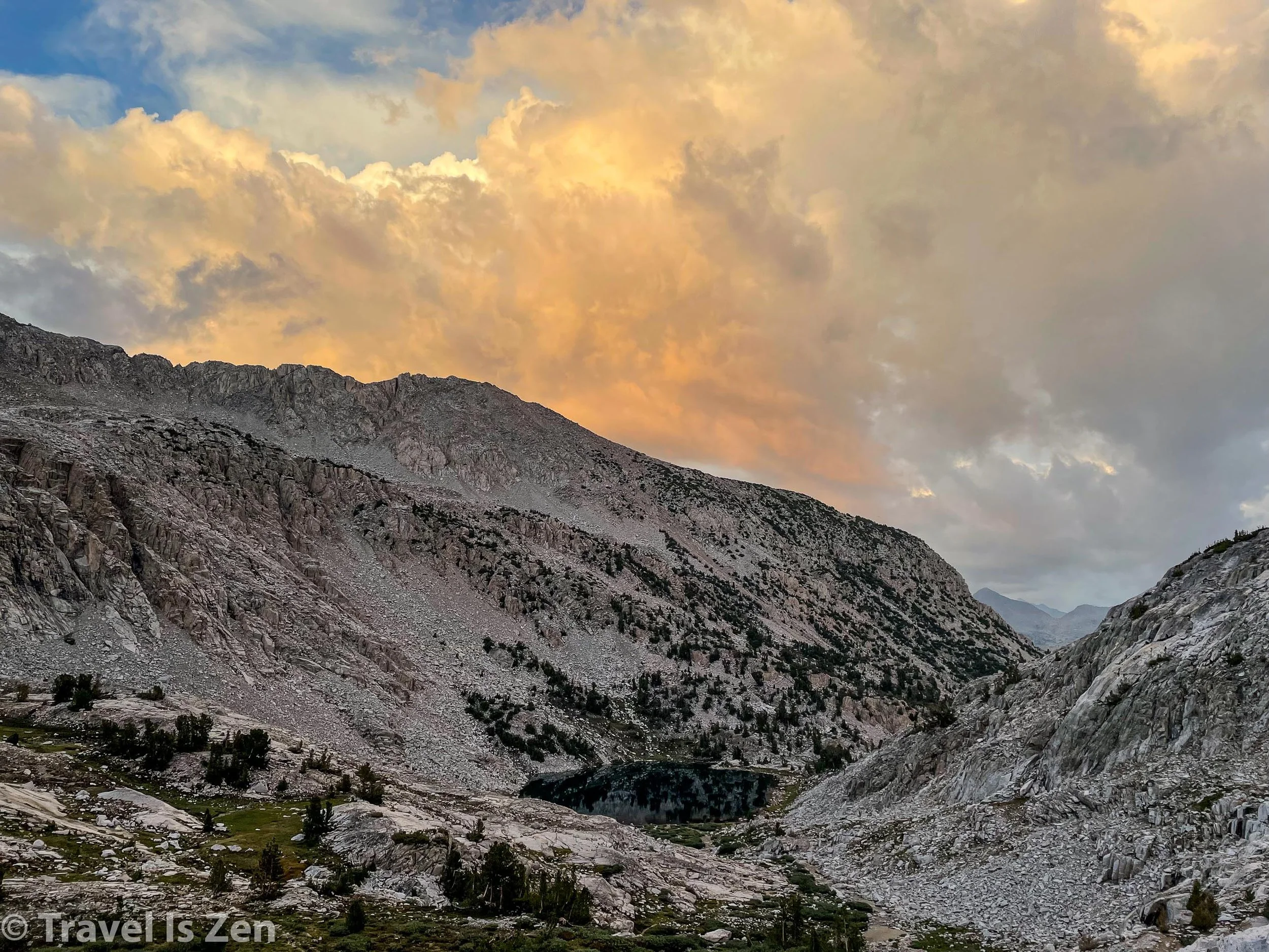
Camp #12: Below Muir Pass (14 miles) @ 11,200 feet
Due to the weather, we had camped 3 miles earlier than planned. To cross Muir Pass before the now-routine drenching afternoon storm, we needed to get an early start. We broke camp in the dark at 4:30 a.m. and started walking before sunrise. The morning air was cool, dewey, and peaceful as we strode through Evolution, McClure and Colby meadows, watching Hermit Peak emerge from the shadows.
Note: For image slide-show, click on any photo.


Hermit Peak heading to Evolution Lake
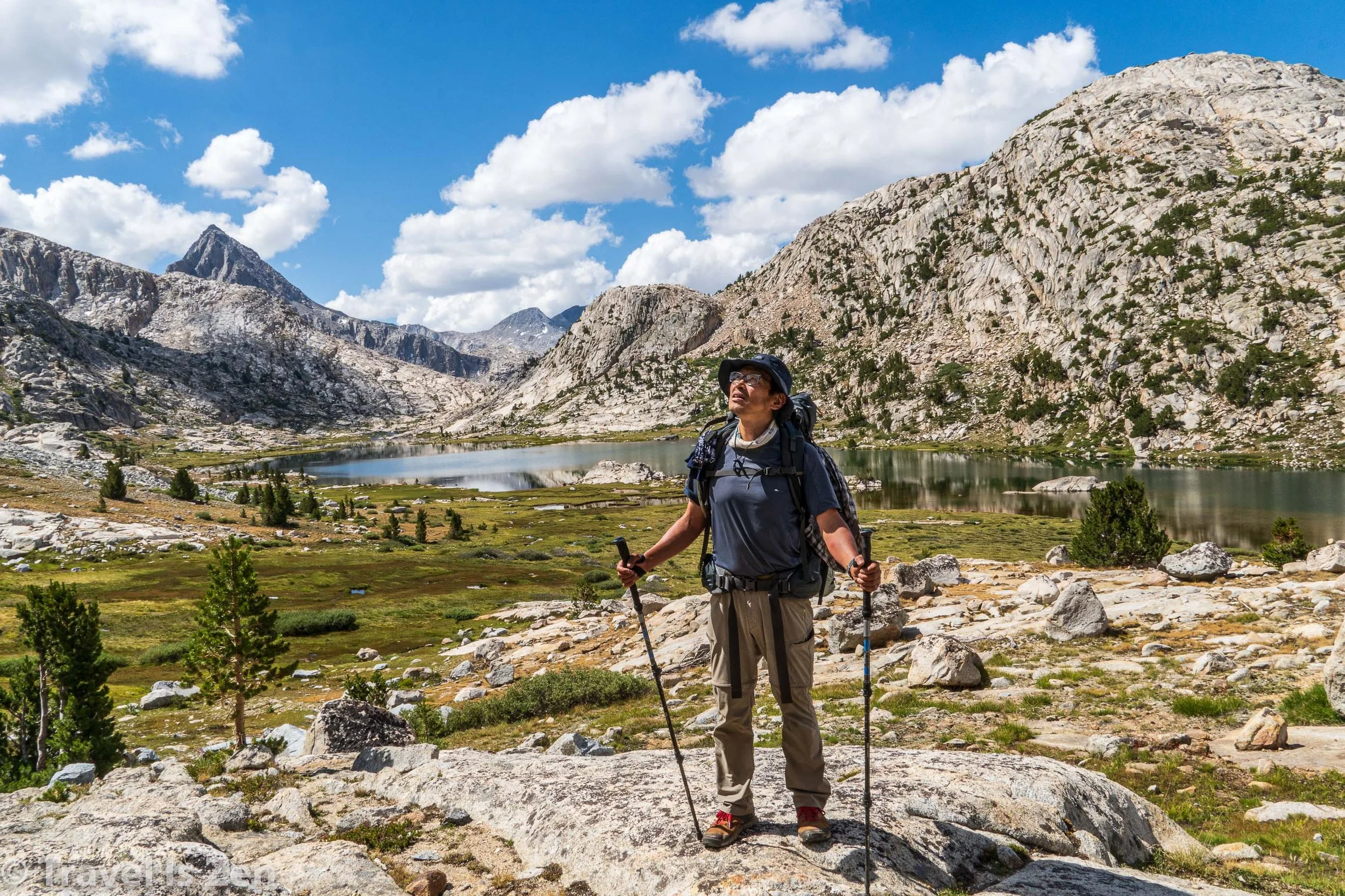
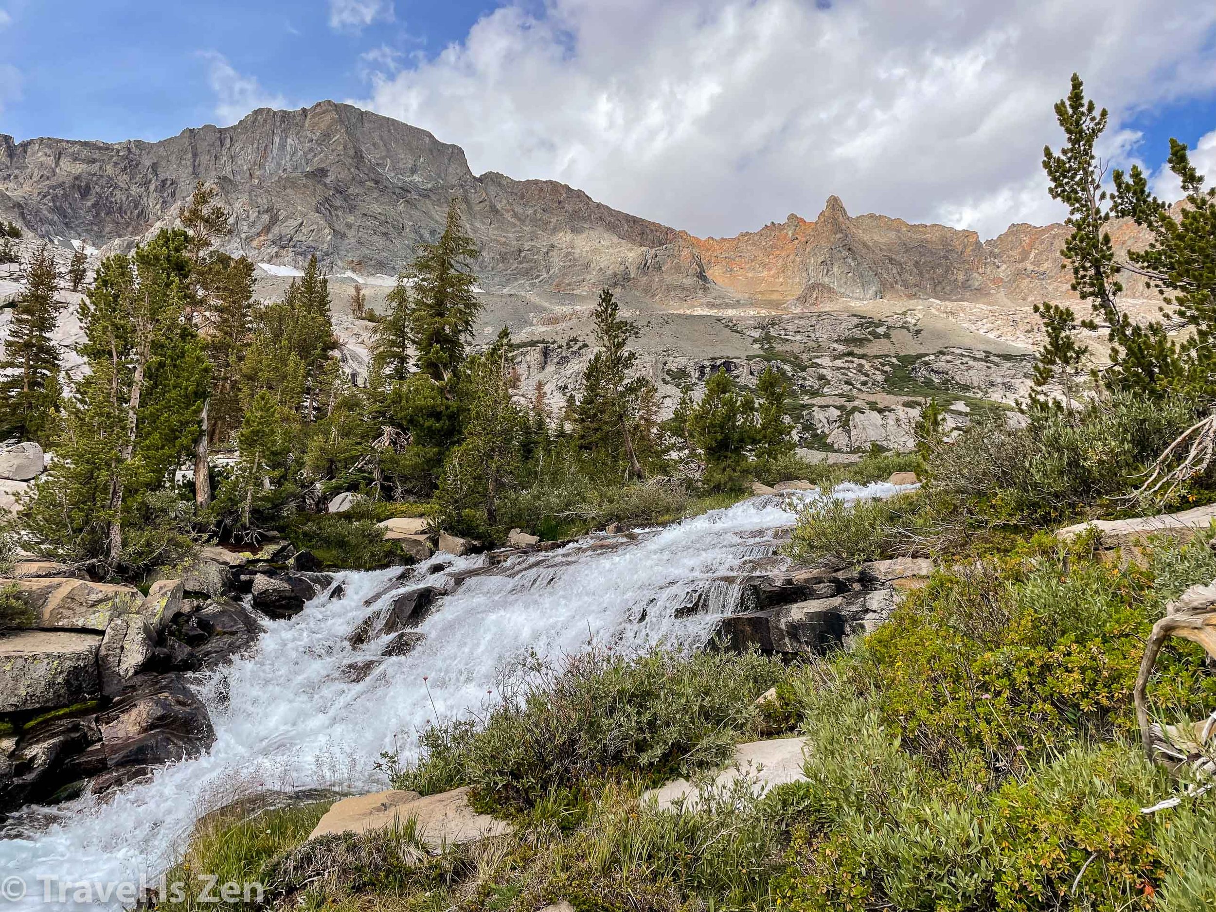
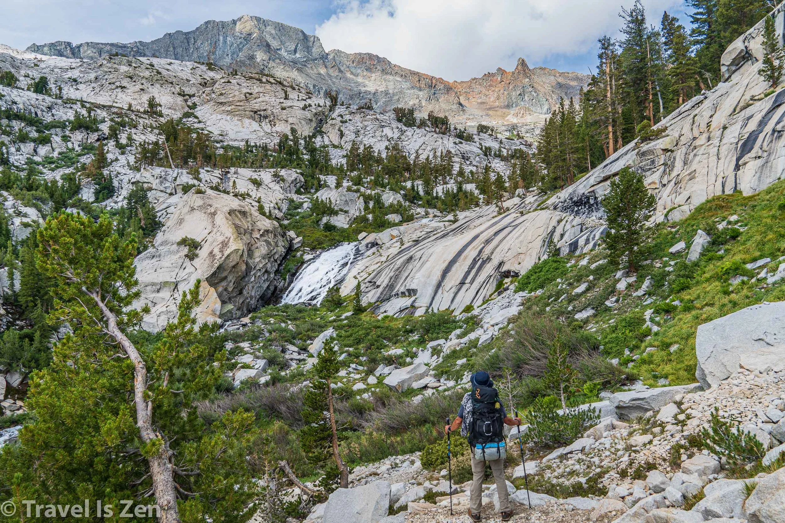
After an arduous climb to Evolution Creek, we spread our gear out to dry (again) and basked in the sunshine for an hour. It was still pretty early, but we had a long way to go, so we set an aggressive pace to Muir Pass, charging up a gradual, 1,000 foot incline past several lakes (Evolution, Sapphire, and Wanda) flanked by a who’s-who of 13,000 foot peaks (Mendel, Darwin, Mts. Spencer, Huxley and Fiske).
Note: For image slide-show, click on any photo.


We did not stop for lunch, as we could see the clouds growing larger and darker as we neared the pass. We snapped our vanity photos at Muir Pass around 2:00 p.m., but we didn’t linger long. A seriously black cloud grew increasingly angrier as we headed down towards Helen Lake.


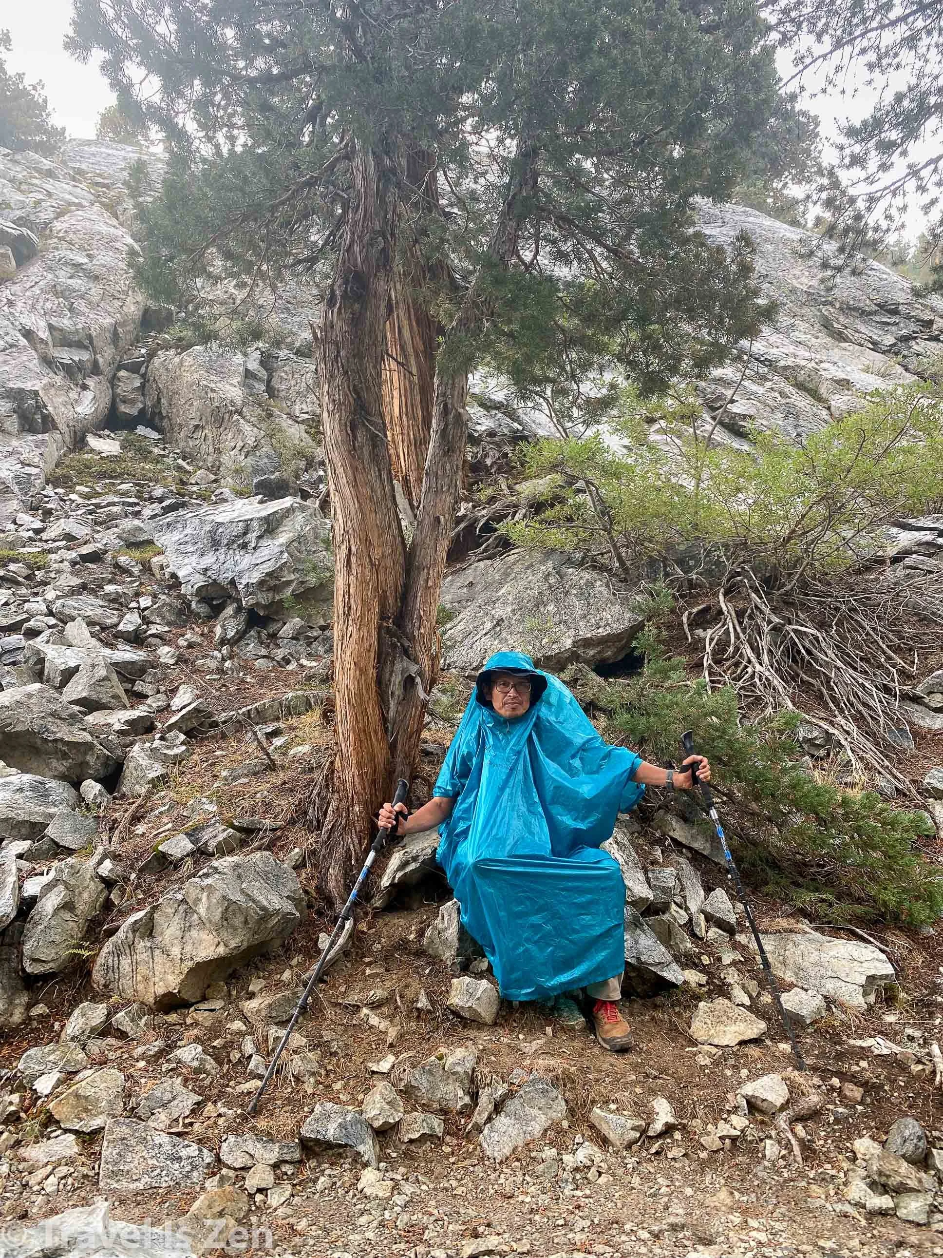
The wind whipped and thunder rumbled. It was unnervingly slow going over a treacherous, rocky path, donned once again in an over-size cumbersome poncho. Just as we arrived at the first viable-looking camp spot, we were pelted by hail. We threw down our packs and frantically dug out the tent. A torrential rain mixed with the hail and the wind howled as we unfurled the tent, drove the stakes into the loose sand, propped up the entries with a set of poles, tossed in our backpacks and dove inside. The wind yanked several tent stakes from the ground within seconds. We grabbed the poles and the canvas door flaps in our hands, holding on tight to keep the tent upright as the storm unleashed.


Lightening flashed and thunder boomed; the hail and rain were incessant. 10 minutes. 20 minutes. 40 minutes. Good god! How long would this last? Our shoes outside the tent bobbed and floated in the muddy water collecting around and beneath the tent. The tub of the tent swelled around us like a cold waterbed. The puddle crept higher and threatened to breach the tub. We moved closer to the center, pulling the bottom higher up the poles to which we were still clinging. We were still dry, but I was shivering and my teeth were chattering. The possibility of hypothermia began to feel very real. The storm showed no sign of abating, but we had to do something. Caffrey grabbed our Deuce of Spades as I took over the responsibility of holding upright both sides of the tent. He somehow managed to exit and yank a poncho over his head. In the driving rain, he attacked the ground, attempting to scrape a drainage trench to release the swirling puddle. It was too late, though. A wind gust blew another stake out at the base of the tent and the side collapsed. I screamed as the water breached the tent basin. We had to abandon the tent.
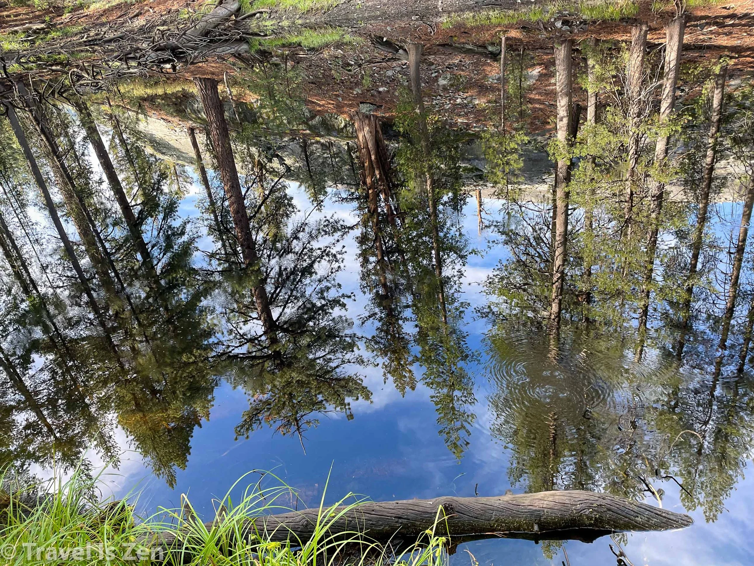
Caffrey stuck his arm in, grabbed a backpack and ran up to our friend Dan’s tent, which was just above ours (and still dry inside). Tossing in the first bag, he returned for the second, with Dan on his heels. At that moment — after two long hours — the rain mercifully slowed to a drizzle. I climbed out and they were able to move the tent out of the flood zone to a flat area just opposite the bushes next to us. I was shaking from fear, cold, and exhaustion. (The picture below is the slightly-drained puddle that collected around our tent. It looks benign in hindsight, but in the throes of a severe storm, it felt like we were in the midst of a great flood! <blush> Anyways, we learned the hard way that not all “flat” ground is a suitable tent site.)


With the tent now reconstructed on higher, sturdier ground, we retrieved our bags from Dan’s tent and I focused on getting warm and dry. I was relieved to find that the inside of the tent wasn’t soaked. A few swipes of the basin with a handkerchief was all that was needed. I set up the sleeping mats and bags and changed into warm, dry clothes. We made hot chocolate and watched the last remnants of the storm continue down the valley. An eerie orange glow warmed to a few waning rays of sunshine. It was certainly a day of high drama that shook all of us. I had never felt that vulnerable and helpless in nature; it was humbling. Elevation gain from the wee hours of the morning at Evolution Creek to Muir Pass was 3,118 feet, with a descent of 1,190 feet just past Helen Lake. Slope averaged 303 feet/mile.
Camp #13: Palisades Creek (10.3 miles) @ 8,400 feet
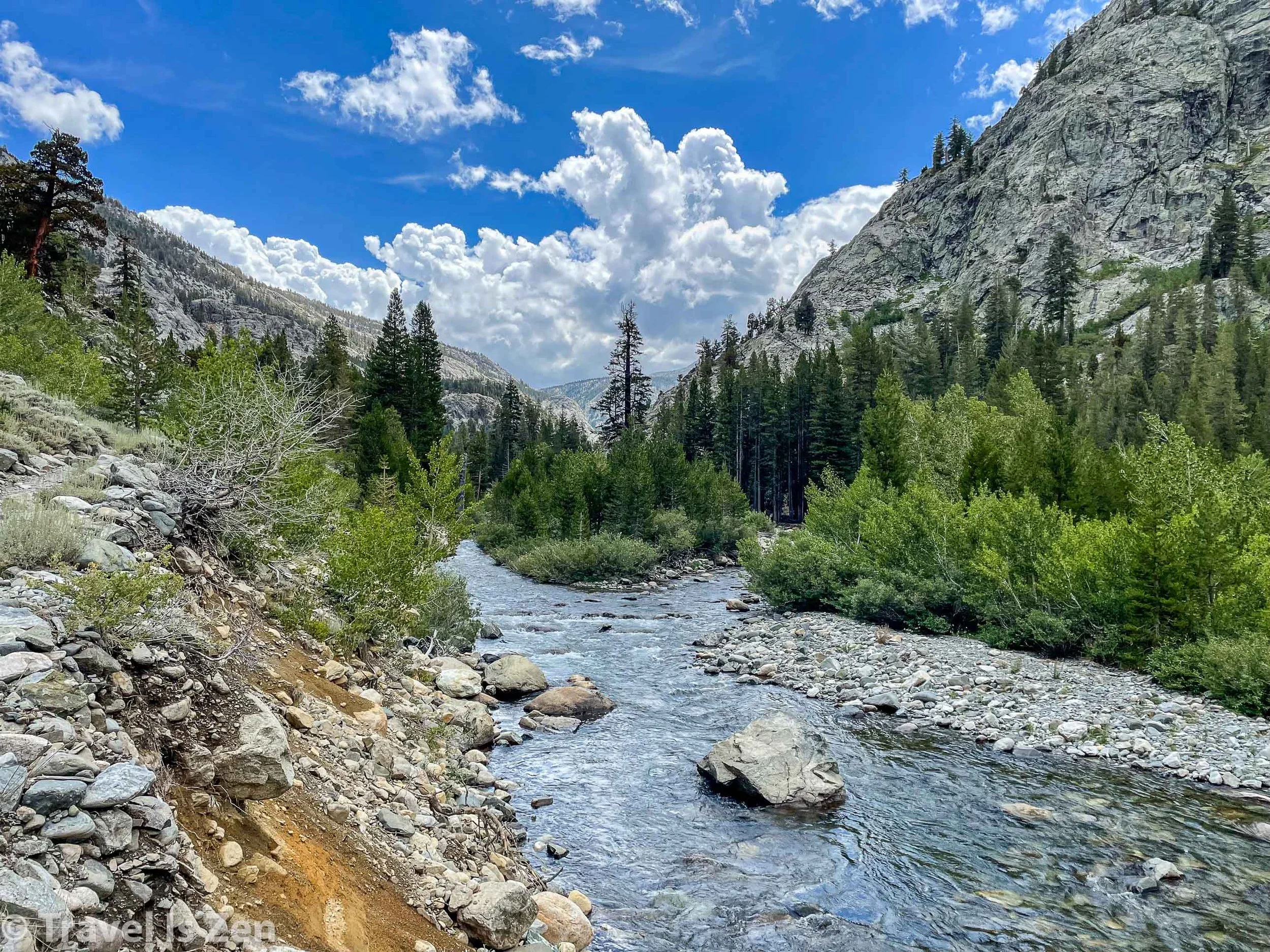
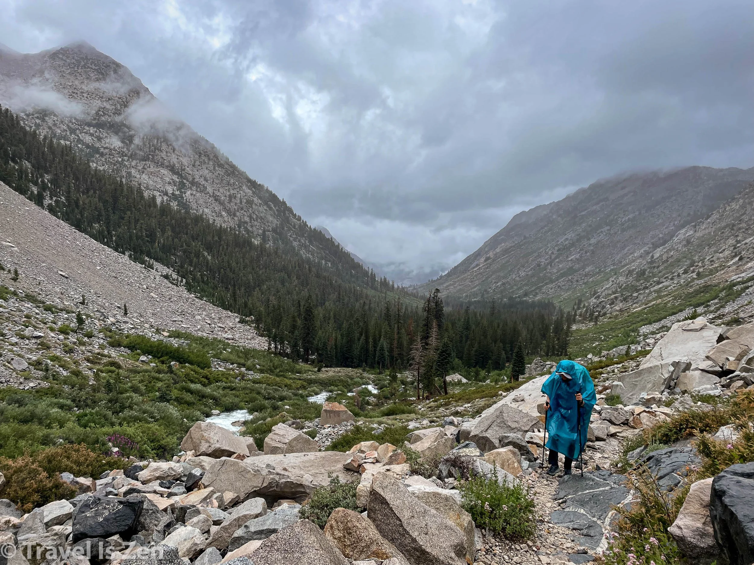
We awoke to blue skies and sunshine on day 14. I was optimistic that the worst was over and we broke camp with smiles. It was a continuous downhill for most of the day, through Big Pete’s Meadow and Le Conte Canyon. In contrast to yesterday’s stark, rocky landscape, the descent through the valley was lush and colorful — waterfalls and wildflowers, aspens and pine.
Note: For image slide-show, click on any photo.


Le Conte Canyon, Sierra Nevadas, California
We stopped for lunch just past the Bishop Pass junction. As we ate lunch, I toyed with the idea of exiting the trail at Bishop. We realized this morning that we were a day short of food. In our hurry to re-pack before the station closed at Muir Trail Ranch (in the pouring rain), we had miscalculated our meal plan to Independence. We weren’t going to starve, but it was going to be tight… and any delays caused by an impassable creek, accidental injury, or backtrack due to a landslide weighed on my mind. I kept quiet, though, and we continued downhill after lunch. Within a half hour, black clouds snuck through a divide in the canyon and infiltrated the valley below us. Caffrey and I opted to pitch the tent on a rocky ledge above the building storm; Dan continued on the path into the grey mist. Thunder, lightening, another heavy downpour and cold wind ensued. We were on the edge of the turmoil, though, in a sturdy tent sheltered by trees. We had an afternoon nap, warm and dry, until the storm tapered off about two hours later.
Note: For image slide-show, click on any photo.


We packed up and continued down into the valley to meet up with Dan at our designated campsite. We settled into a busy camp area around 6:00 p.m., giving us a short window of time to clean ourselves in the creek and make dinner. I hung my soaking wet socks, undies, and handkerchief beneath a thick, dry pine tree. We were rationing food; I hadn’t slept well in days; the mosquitos were swarming; my socks seemed eternally wet. At one point in the evening, I freaked out when I couldn’t find my phone (it was beneath my sleeping pad)… and then Caffrey showed me the giant red burning lump on his forearm that looked like a spider bite. * great *. My nerves were shot. I wrote in my journal that evening that the next five days — facing four high mountain passes and drenching storms — were going to be “the longest five days of my life”. We were “more remote than I ever expected. There seems to be no easy exit!” Yeah. My spirit was waning and I was having a tough time staying positive. And then it poured ALL NIGHT LONG. Total descent through Le Conte Canyon was 3,208 feet, with just minor inclines. Average grade was 355 feet/mile.
Camp #14: Bishop Pass Junction (13.6 miles) @ 8,600 feet
Day #15 on the John Muir Trail. This is the day my spirit broke. This is the day I earned my trail name: Turnaround. This is the day that replays in my mind over and over, re-living the “what if’s” and examining all the justifications I had for turning around to see if they still hold up in hindsight.

Carefree, Dan, Turnaround (fake smile)
We were awake at 5:00 a.m., but the rain poured and thunder rumbled for another three or four hours before we could get out of the tent. The items I had hung to dry were, of course, soaked. I wrung out my socks; my mood matched their sour odor and the grey gloom of the heavy clouds. A woman in our campsite had bailed this morning after her tent flooded, headed back to Bishop Pass. I had my mind set on an exit at Taboose Pass, just after Mather Pass. I would go it alone, if necessary.
We ate a small (rationed) breakfast in full mosquito battle armor, wiped down the tent as much as we could, packed up and began walking in a drizzle towards the Golden Staircase. There was no sunshine — not even the promise of sun. Palisade Creek was a raging torrent. We waded across several flooded feeder creeks. I recall them as being “treacherous”, but Caffrey and Dan described them as merely “swollen”. Each of us has our own perspective of the day’s events, shaped by individual risk tolerance, state of mind, and who we encountered.


As we ascended the Golden Staircase, I spoke with a few people coming down. One woman told me the creek crossings at elevation were really bad and getting worse; weather forecasts predicted at least two more days of monsoon rain. An older gentleman, bloodied and bruised, was on his way back to Bishop Pass after slipping on the wet rocks and injuring his finger. His hiking partner advised me to bail, insisting that these storms were unprecedented. He’d been coming to the Sierras for years and had never felt this endangered. I told him I was thinking of exiting at Taboose or Sawmill Pass, another couple of days ahead. He told me the roads to those trailheads were closed due to rockslides and flooding and he cautioned against those less-maintained trails.
Thicker blacker clouds were descending from Mather Pass and Lake Palisade above us. Unrelenting. We were about half way up the Golden Staircase; I was walking super slow, head hanging, sniffling. That’s when I yelled to Caffrey that I wanted to turn around — I wanted to follow the crowd 20 miles back to Bishop Pass and exit the trail. I couldn’t see the point of continuing onward for another several days in monsoon storms, miserable and wet. He could see my spirit was defeated and agreed to turn back (for my sake). Dan chose to keep going. We wished him luck and parted ways.


We ate lunch at the bottom of the staircase. The rain petered out and a weak sun was promising enough to brighten my spirits. For me, it was a sign that we had made the right choice. With a spring in my step and renewed vigor, we walked nearly all the way back to yesterday’s lunch spot near the Bishop Pass junction. We would be back in civilization in two days. That night, the justifications kept cycling in my mind: treacherous water crossings, hypothermia and injury risk, low food and butane, no remaining battery charge for our devices, at least two more days of downpour (cycle again)… I felt bad for Caffrey because I knew he turned around for my sake; he was “Carefree” as usual, though, and I was incredibly grateful. It was an up and down day, ascending 2,647 feet and descending 2,430 feet on slopes averaging 375 feet/mile.
Our John Muir Trail adventure did not end here. As we would discover, the JMT is just a highway with endless offshoots to incredible places. Nine more days of fun, beauty and adventure in the Sierra Nevadas awaited - including Bishop Pass and a Whitney summit!


