
John Muir Trail: Days 19-24 Kearsarge Pass to Mt. Whitney Portal
Our final five day push to Mt. Whitney! This post covers the last leg of our John Muir Trail adventure, from the Onion Valley trailhead near the town of Independence, over Kearsarge Pass, reuniting with the trail at JMT-SOBO mile 180, culminating at Mt. Whitney at mile 211…and beyond. Highlights in this section include: Kearsarge Pass, Forrester Pass, Bighorn Plateau, Crabtree Meadow, Guitar Lake, Mt. Whitney summit and exit through Mt. Whitney portal, including Lone Pine Lake, Trail Camp, and Outpost Camp.
Note: For image slide-show, click on any photo.


Camp #19: below Forester Pass (13.2 miles) @ 11,500 feet
Mt. Williamson Motel fed us well for breakfast: english muffins, eggs, fruit cup, orange juice, coffee, and bacon for those who wanted it. We weighed our fully-loaded packs for the last leg and chatted with others headed back to the trail.


The nice folks at Mt. Williamson motel shuttled us a mile UP from Independence (just under 4,000 feet) to Onion Valley trailhead (9,200 feet elevation) at 8:00 a.m., a nice head start on Kearsarge Pass. It was a long (but sunny!) climb past a few alpine lakes, across a large cirque, and loads of switchbacks to the top.

Headed to Kearsarge Pass from Onion Valley


The views from Kearsarge — east to the low plains across to the White Mountains and west into the Sierra Nevadas — were nothing short of spectacular.

View west from Kearsarge Pass
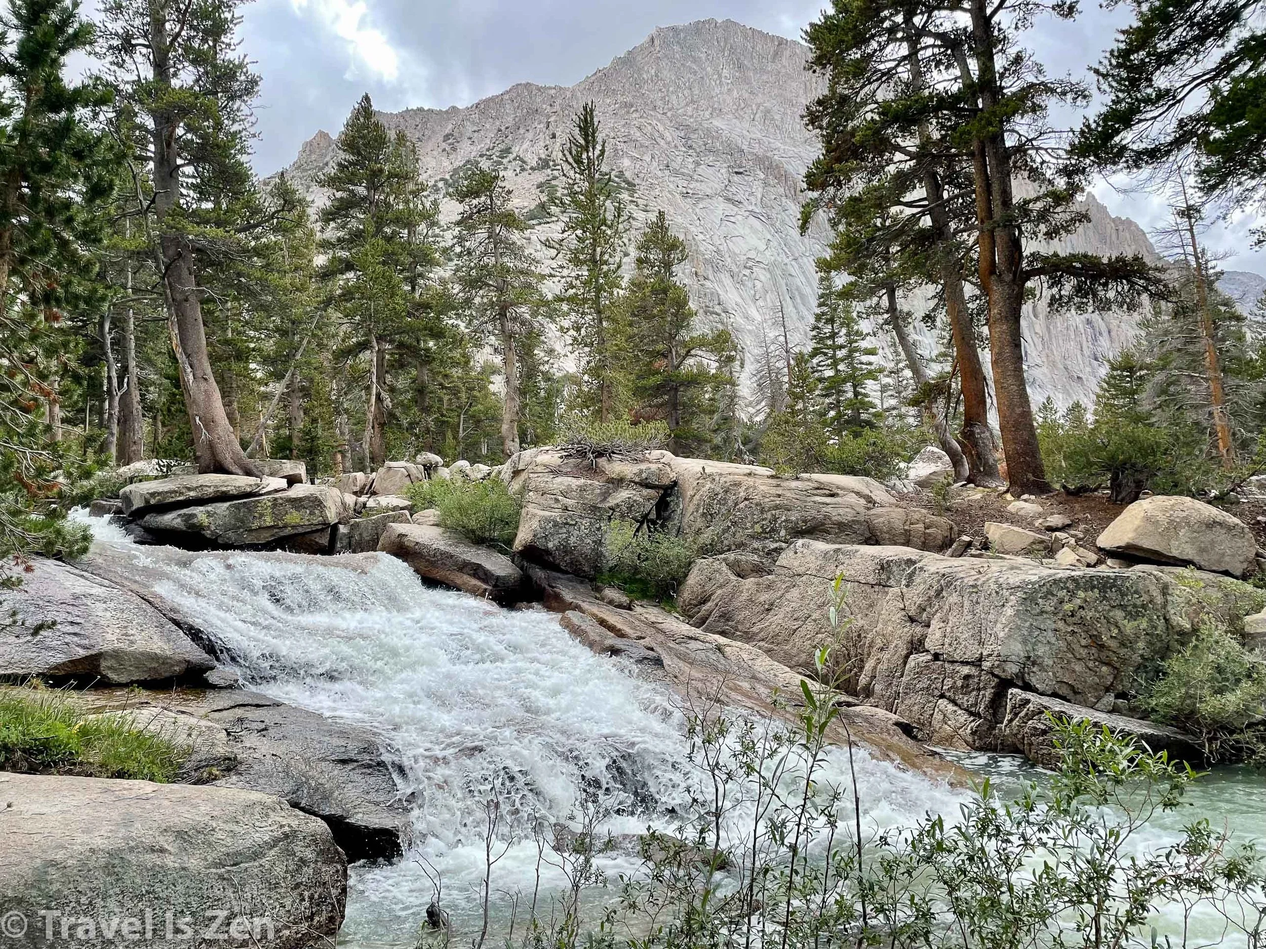
From Kearsarge Pass, it was another zig-zag descent down to the lakes. We ate lunch at Bullfrog Pond and continued a gradual decline through a sloping U-shaped valley to Bubbs Creek, followed by a steep descent into the pine forest. With Center Peak as an obvious landmark, we could trace the trail up to Forester Pass with our eyes and we began the long ascent.
Note: For image slide-show, click on any photo.


The weather was perfect and we had fresh legs, so we continued beyond our planned campsite to a broad basin about 2,000 feet below Forester Pass. There were far fewer people here and we found the perfect little nook across a small stream. We settled in just before dinner. The sunset was nothing short of a blazing glory that we were truly privileged to have witnessed!


Lots of elevation gain/loss today: 4,374 feet ascent and 2,347 feet descent over slopes averaging a whopping 511 feet/mile. Yowsa! Awesome start to our final leg!
Camp #20: Wright Creek (11.68 miles) @ 10,700 feet
In addition to the spectacular sunset, we had a super moon overnight. It was also super cold! Despite pulling on all layers, we didn’t sleep well. To get the blood pumping, we got an early start, headed aggressively uphill three miles to Forester Pass.


morning sun hitting Kings Kern Divide
Switchback, switchback, switchback… We had camped a little higher than others, so we were among the first to reach the top, just above 13,000 feet. As with other Sierra Nevada mountain passes, the views were incredible (without that pesky monsoon cloud cover)! There was a STEEP drop-off on the other side of the pass to a broad, wide open plateau far below. From the ridge, it was hard to tell exactly how the trail descended. As we started down, though, we could see the switchback hugging the escarpment to the floor below.
Note: For image slide-show, click on any photo.


Forester Pass NOBO view (the cantilevered crack in the cliffside)
There’s quite a shift in scenery after crossing Forester Pass and into Sequoia National Park. Headed southbound, the landscape becomes a vast and spacious plain compared to the towering peaks, ridges and canyons on the opposite side. It was drier, sunnier, and the slopes more gradual. The marmots were bolder and more curious. Sequoia trees - windswept and weather-hardened. Overhead, fighter jets painted the sky .
Note: For image slide-show, click on any photo.


As we made our way downward, a swirl of dust in the distance took shape as a horse caravan headed towards the Pass. Further along, we stopped for lunch beside Tyndall Creek, not a care in the world. It was just sunshine and daydreams. This stretch of the trail is so incredibly photogenic - please pardon my over-share of photos.

A horse caravan on its way to Forester Pass


After lunch, we found ourselves headed uphill for a bit. Just above the tree line, there was another dramatic shift in scenery. Bighorn plateau was another world! Barren, dry as a bone, littered with tree carcasses. Just past the shrinking lake at the top, a leftward curve in the trail revealed Mt. Whitney for the first time. Incredible to believe that we would be at its summit in just two more days!

Bighorn Plateau
Note: For image slide-show, click on any photo.


Mt. Whitney, California Sierra Nevadas
A final easy descent into the trees led us to a secluded camp spot along Wright Creek. We enjoyed a few hours of late afternoon sun before dinner and darkness. We covered a lot of terrain, ascending 2,476 feet and descending 3,009 feet on slopes averaging 478 feet/mile. Scenery overload! Loved every minute of sunshine and dry socks.


Camp #21: Guitar Lake (8 miles) @ 11,500 feet
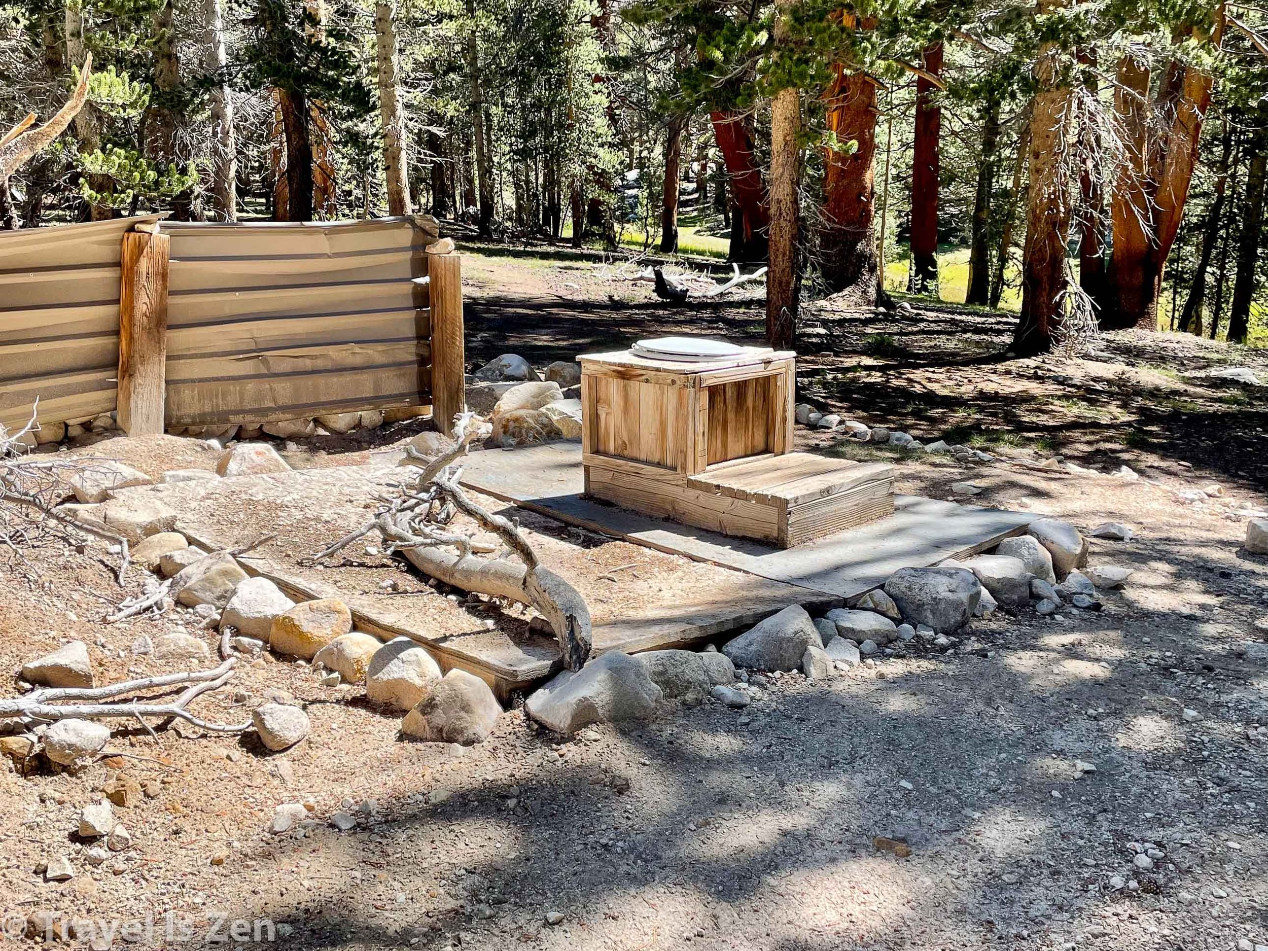
Relatively short hike today to Guitar Lake, our staging point for the Mt. Whitney summit. It was a brisk morning, but warmed up with the sunrise. We had early #wins crossing Wright and Wallace Creeks, avoiding wet feet by using accessible rock hops and a hidden log crossing. We walked through a dusty and sparse sequoia forest before heading above the tree line to Crabtree Meadow. Our plan was to snatch some wag-bags from the ranger station before heading into the Mt. Whitney area, but there was nobody at the station and no wag-bags in sight. Yikes. Past Crabtree Meadow until exiting Whitney Portal, hikers are not supposed to leave human waste of any kind — including cat-holes. Hmmmm… We giggled at the “throne” in the middle of the meadow, but I secretly considered that my “plan B”.

At Crabtree Meadow, we chatted for a long while with Mindy “Cliff Squatter” and Aaron “Weatherman” from Bakersfield (Hi!). Later in the day at Guitar Lake, we met up with Nurse Catherine from Denver (Hi!), who Dan had met while C and I were exploring Bishop Pass. Guitar Lake had a party atmosphere, with excitement in the air. We would all be attempting a summit at some point the next day. The weather outlook was excellent and we were anticipating another super-moon, if the skies were clear. A gorgeous sunset topped off another amazing day on the trail.
Note: For image slide-show, click on any photo.

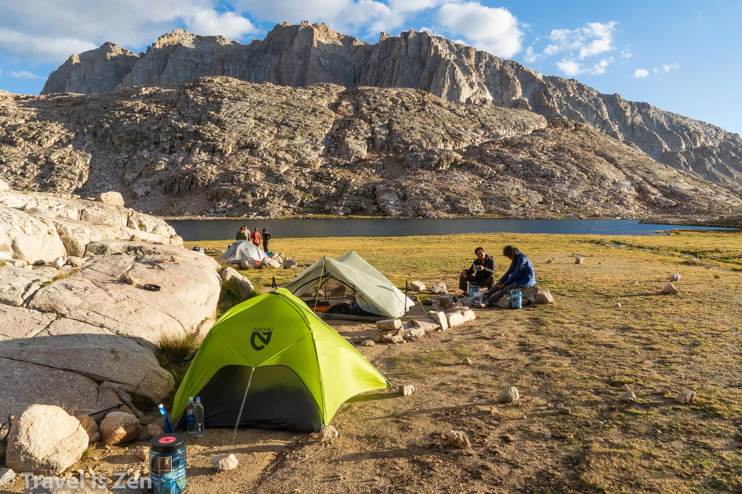


Guitar Lake
I laid in the tent that night wondering how our ascent of Mt. Whitney — the highest peak in the continental United States — would ultimately play out. Would it be hard to breathe? Too windy to endure? Would the weather cooperate? We had come a long way in terms of preparation for this - with our day summits of Mts. Elbert and Massive in Colorado back in June/July and all of the high Sierra mountain passes we had crossed in the past three weeks. Regardless, I had a twinge of anxiety… and also sadness that our JMT adventure was coming to its end! It didn’t seem real! I would have a lot to process in the coming weeks. We had been through so much on this 200+ mile stretch of dirt in southern California: we had learned a lot, been humbled, amazed ourselves, experienced highs and lows - EVERY DAY. We had met incredible, like-minded people that we would miss dearly: Hugo, Karina, Catherine… and many others. Needless to say, I didn’t get much sleep on “summit night”.
Camp #23: Outpost Camp (11 miles) @ 11,400 feet
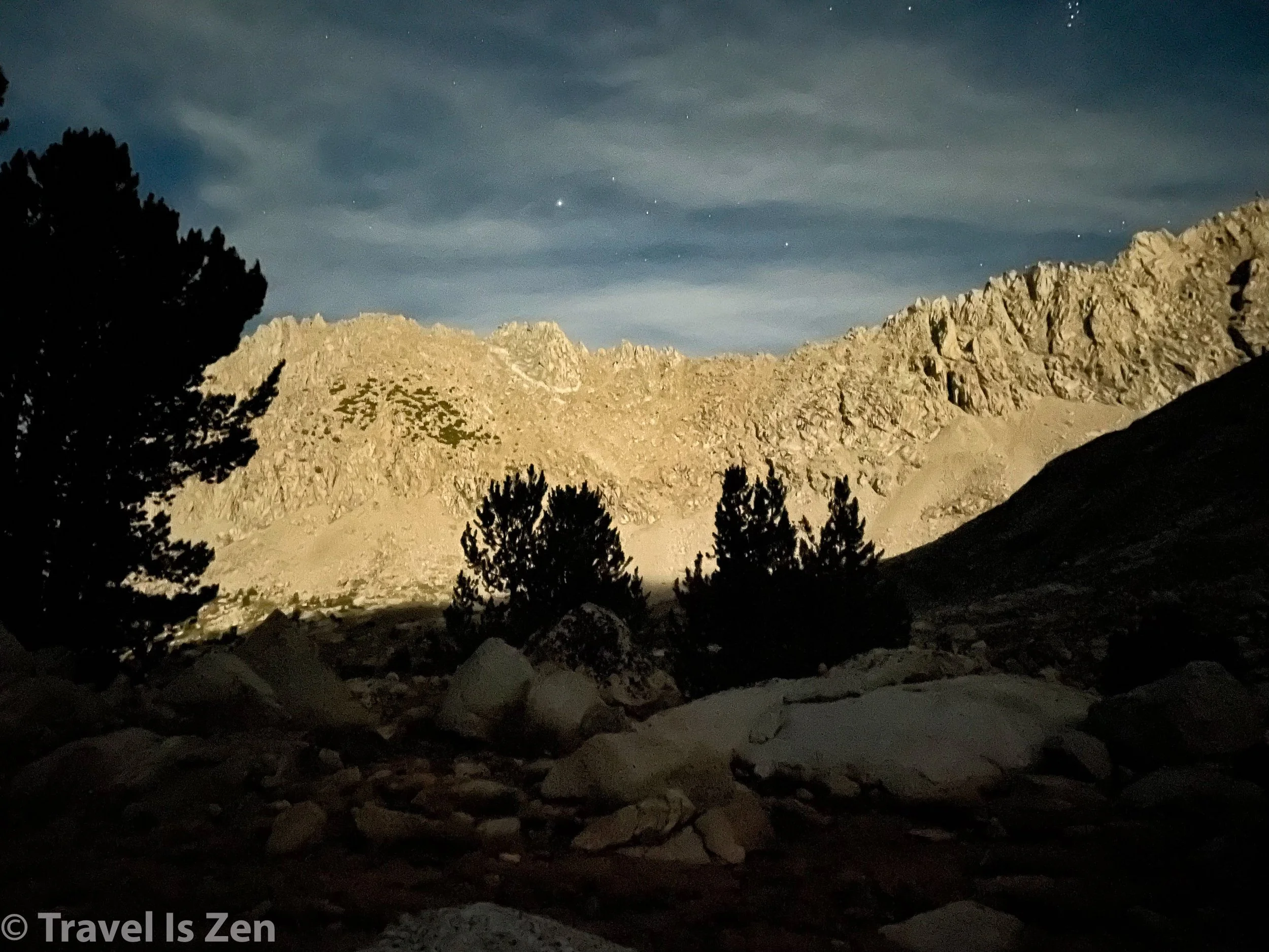
Alarms buzzed in unison at 3:00 a.m. We emerged from our tents and gazed at the incredible night sky. Even with a super-moon casting night-shadows, the milky way was clear and bright! I even witnessed a shooting star! It was about 48 degrees, no wind, not a cloud in the sky. Absolutely perfect. We were packed up and headed for the switchbacks by 4:00 in bright moonlight. Twinkling headlamps from the midnight hikers snaked up the ridge line.


We all walked at our own pace and I drifted back a bit from Carefree and Dan. I enjoyed the sound of my breath and the intermittent squeaks of marmots in the shadows. Slow and steady; no reason to hurry. The climb to Trail Crest Pass was a 3,000 foot switchback climb up to 13,700 feet. We arrived as planned at 6:00 a.m. After stashing our backpacks alongside those of earlier hikers, we ate a snack, slung on light-weight day sacks, and continued upward. The sun crested the horizon, painting the sky with pink, orange, and yellow bands and casting turquoise and purple shadows.


Climbing to Mt. Whitney summit, dawn.
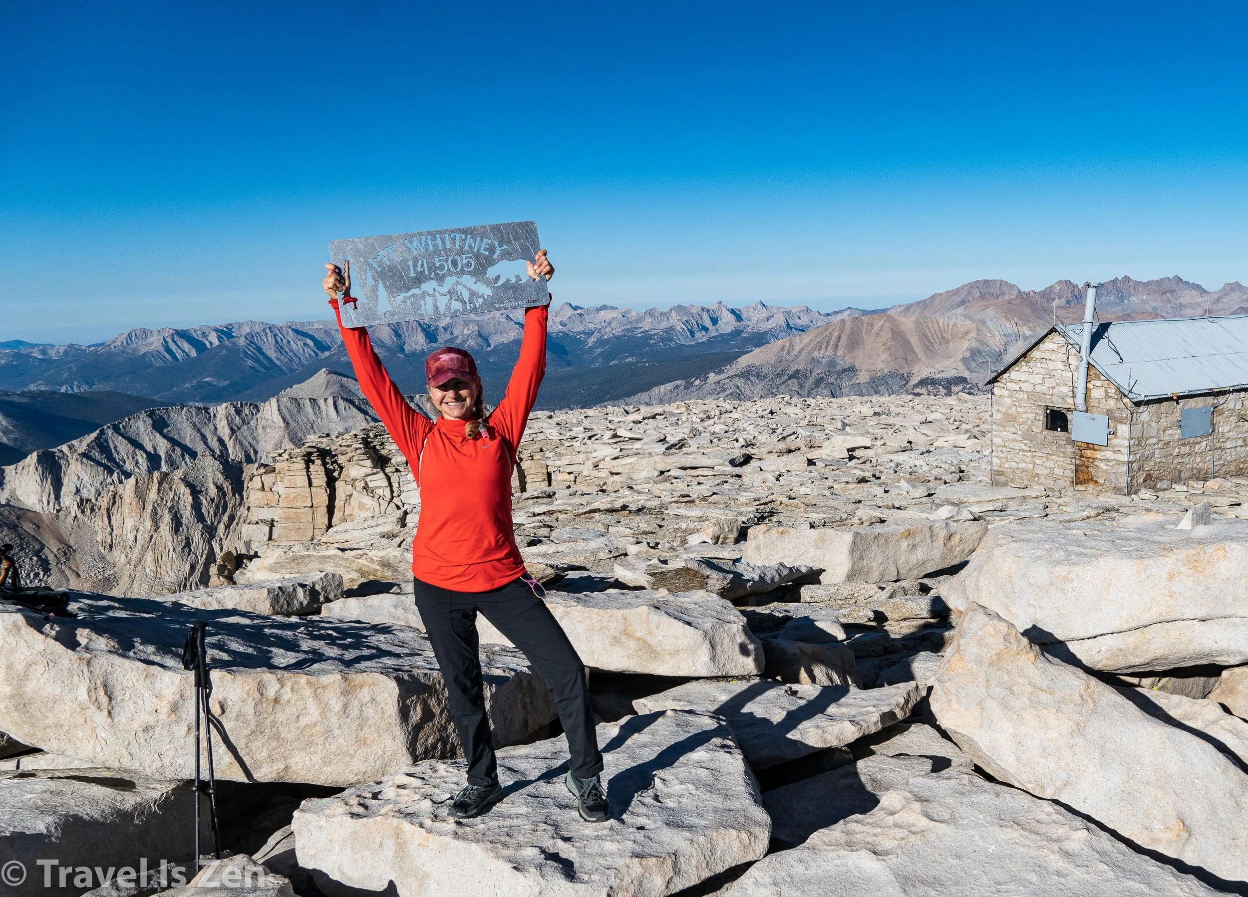
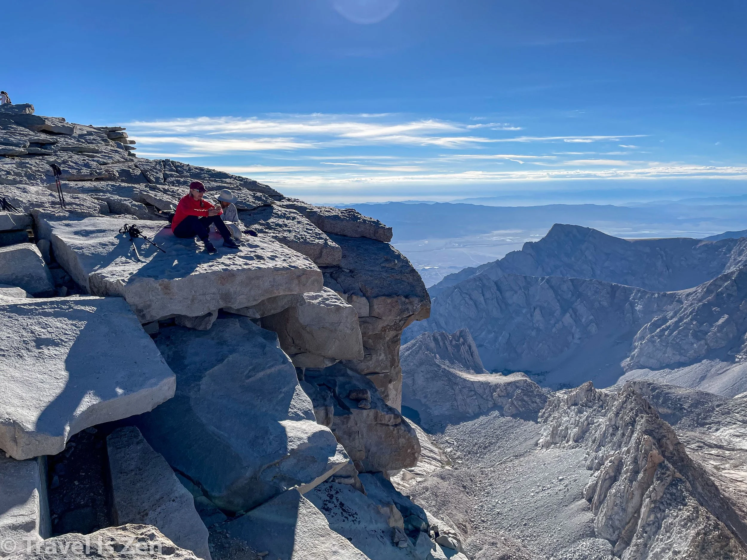
The summit trail was rocky, with steep drop-offs on either side. We had glimpses of Lone Pine 10,000 feet below, with the White Mountains far in the distance and bird’s eye views of Guitar and Hitchcock Lakes. Stunning granite pillars towered above us, thrusting into the sky. As the sun climbed higher, so did we, eventually reaching the half mile stretch across Whitney’s three “needles”. The climb was gradual (gradient about 350 feet/mile) and far easier than any Colorado summit. With high spirits, we greeted and passed exhausted day hikers who had climbed from the portal. We crested the summit at 8:30 in the morning, with blue skies, no wind, and pristine views.


There were about 10 other hikers at the top and we waited a while for the metal signs to pass to us for our “yay we did it” shots. We signed the book, peeked inside the lightening-rod-metal hut, then perched on a ledge for another snack. We savored the views for another hour… lingering… not wanting to leave. This was “the end”. We had done it. We finished the trail (in our own way). We reached the highest summit in the continental United States. Technically, we were done. It was time to go home. Time to return to “real” life. We held onto our last moments of peace and accomplishment...


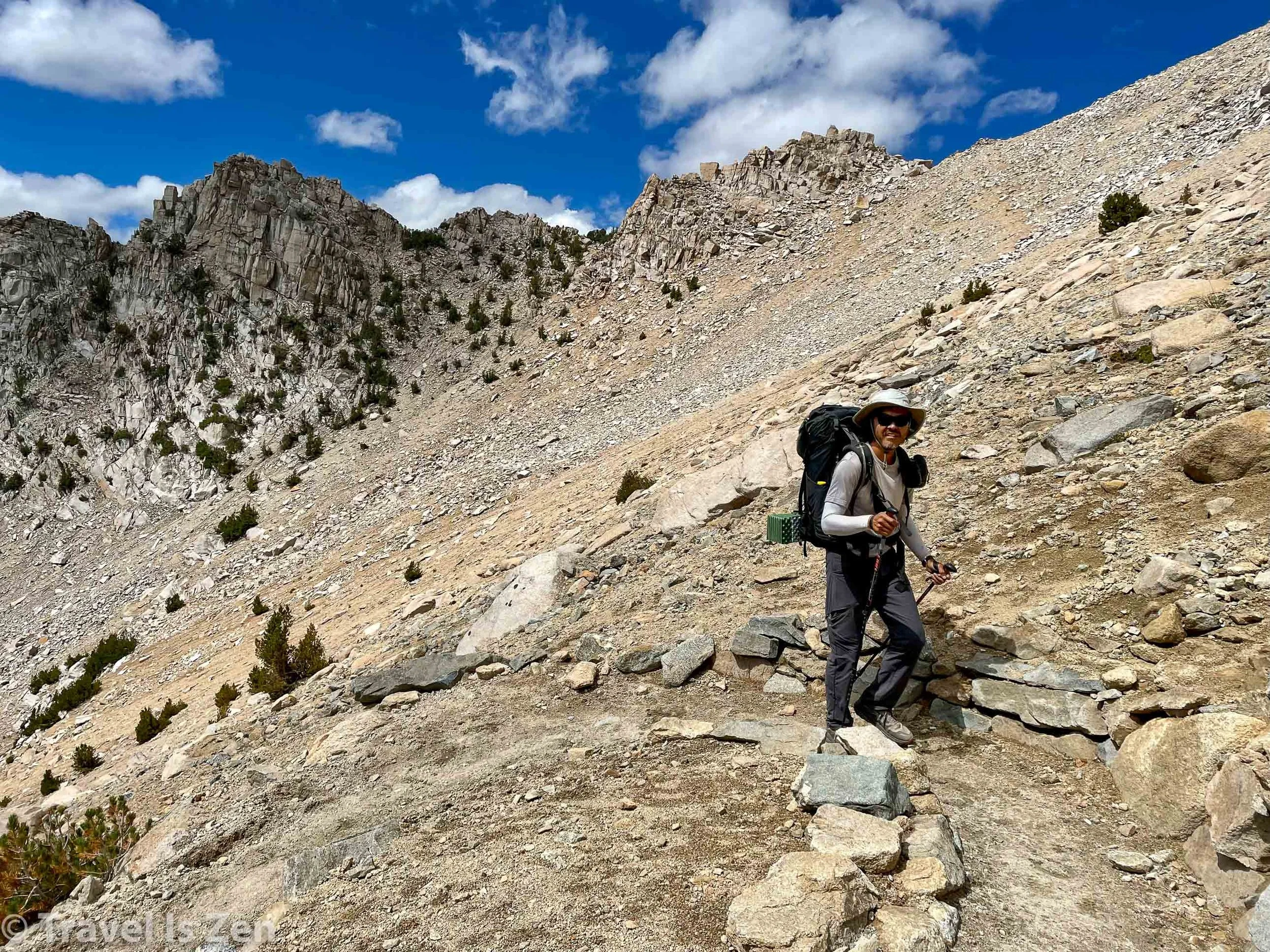
Knowing we still had a long hike down, we eventually exited our perch at the top of the country and retraced our steps back to Trail Crest Pass. Trail Crest was bustling with loud talking day hiking groups and over-age selfie lovers. Our noses wrinkled at their flowery shampoo smell. We were relieved to have had our moment at the summit in relative calm. Hoisting on our backpacks, we doubled-stepped out of Trail Crest and headed for the 99 switchbacks. Most people think the challenge of a mountain summit is the hike up. In reality, that’s only the half-way point. We were tired and hungry and still had 2,000+ very steep feet to descend before a real meal.


Trail Camp — with dozens of yellow and orange tents — takes shape about 3/4 of the way down a monotonous set of tight switchbacks under the full blaze of a southern California sunshine. We arrived at around 12:30 p.m. It was gross - crowded, noisy, smelly. We set up the tent and fell into a deep sleep. When we awoke a couple of hours later, Caffrey and I had a headache and overall weren’t feeling the vibe at Trail Camp. Dan was nursing a sore foot and reluctant to leave, so C and I packed up and headed another 1,500 feet lower to Outpost Camp. When I saw the sparkling waterfall, green trees, clean water and soft ground, I knew we’d made the right choice.


We were still at elevation, camped above 10,000 feet. We enjoyed our last evening in thin, cool, quiet air. With the weight of our adventure coming to its end, we had no trouble sleeping that night. Total ascent from Guitar Lake to Mt. Whitney Summit was 4,380 feet, with a total descent to Outpost Camp of 3,270 feet. Slopes averaged 688 feet/mile - the steepest we had encountered over the entire 200+ mile hike. We were asleep by 6:30 p.m.
Final Day #24: Whitney Portal Exit (4 miles) @ 8,400 feet
We were waiting for Dan to descend from Trail Camp this morning, so we were in no rush. He joined us as we were finishing our last super-charged oatmeal of the trip at 8:00 a.m. Day #24. Our last day on the trail.

Day #24 for the three amigos: Carefree, Turnaround and Dan
It should have been a straight forward hike out. We had less than 4 miles to the Whitney Portal parking lot. Somehow, we managed to make even the last day slightly dramatic. Carried away by the beauty of the Whitney Portal (it actually looks like a portal as you descend!), C and I accidentally veered off onto a side trail to Lone Pine Lake. We talked to fishermen, took photos, and waited waaaay too long for Dan to “catch up” before we realized something was amiss. Caffrey went back up the trail to look for Dan; I could hear him yelling his name further and further UP the trail that we had only just descended. Meanwhile, I talked to a hiker who told me that Dan had passed by our location 30 minutes ago. I checked our location and map and realized that we were 1/4 mile off the trail. Lone Pine Lake sure was beautiful, though, and I’m glad we had drifted.


It took Carefree a while to conclude that Dan hadn’t plunged to his death over a cliff or been mauled by a strange creature. He eventually made it back to the Lone Pine trail junction, where I was already waiting with our packs. I updated him on the news from other hikers and we continued down through the portal, past bright wildflowers and sparkling creeks. Dan pulled up in the van just as we exited the trail. Perfect timing! After dumping our trash and hitting the restroom, we ended up where everyone goes post-hike: burgers, fries and beers at the Whitney Portal Cafe.


After several libations, we offered a ride to a couple of hiker dudes hitching into Lone Pine. We dropped them off in town, snapped a few last photos of Mt. Whitney and the Sierra Mountain Range from town, and then headed to Bishop for long hot showers, soft beds, lots of eating, and rest.

Mt. Whitney from Lone Pine, Eastern Sierras, California
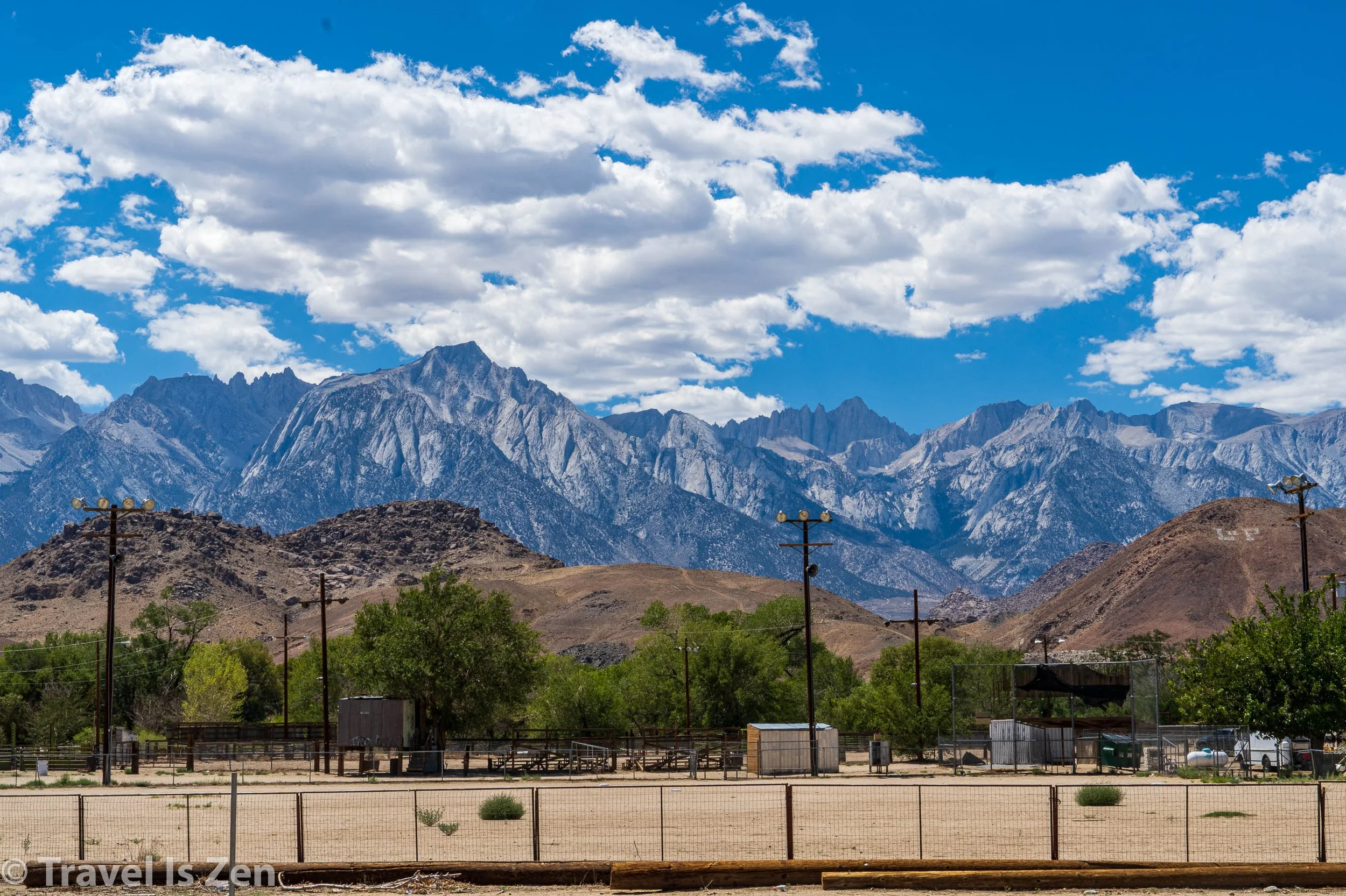
Eastern Sierra, Whitney Portal from Lone Pine, California
The End (of this adventure)


